You are here: Home > Network List > TA - USArray Transportable Network (new EarthScope stations) Stations List
> Station P28A Satin Francis, KS, USA > Earthquake Result Viewer
P28A Satin Francis, KS, USA - Earthquake Result Viewer
*The percent match for this event was below the threshold and hence no stack was calculated.
| Earthquake location: |
Samoa Islands Region |
| Earthquake latitude/longitude: |
-16.4/-172.0 |
| Earthquake time(UTC): |
2009/10/17 (290) 10:45:26 GMT |
| Earthquake Depth: |
10 km |
| Earthquake Magnitude: |
5.7 MB, 5.3 MS, 5.7 MW, 5.7 MW |
| Earthquake Catalog/Contributor: |
WHDF/NEIC |
|
| Network: |
TA USArray Transportable Network (new EarthScope stations) |
| Station: |
P28A Satin Francis, KS, USA |
| Lat/Lon: |
39.57 N/101.75 W |
| Elevation: |
1105 m |
|
| Distance: |
85.8 deg |
| Az: |
46.829 deg |
| Baz: |
244.939 deg |
| Ray Param: |
$rayparam |
*The percent match for this event was below the threshold and hence was not used in the summary stack. |
|
| Radial Match: |
63.96751 % |
| Radial Bump: |
400 |
| Transverse Match: |
68.06318 % |
| Transverse Bump: |
359 |
| SOD ConfigId: |
2622 |
| Insert Time: |
2010-03-06 01:50:45.477 +0000 |
| GWidth: |
2.5 |
| Max Bumps: |
400 |
| Tol: |
0.001 |
|
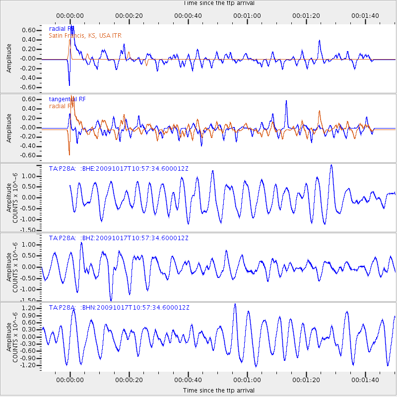
Signal To Noise
| Channel | StoN | STA | LTA |
| TA:P28A: :BHZ:20091017T10:57:34.600012Z | 2.1836255 | 6.575125E-7 | 3.0111048E-7 |
| TA:P28A: :BHN:20091017T10:57:34.600012Z | 1.8967086 | 8.1990913E-7 | 4.3227996E-7 |
| TA:P28A: :BHE:20091017T10:57:34.600012Z | 1.1047441 | 4.9803657E-7 | 4.5081623E-7 |
| Arrivals |
| Ps | |
| PpPs | |
| PsPs/PpSs | |


