You are here: Home > Network List > CN - Canadian National Seismograph Network Stations List
> Station INK INUVIK, NT > Earthquake Result Viewer
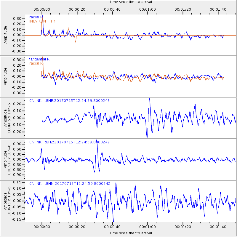
INK INUVIK, NT - Earthquake Result Viewer
*The percent match for this event was below the threshold and hence no stack was calculated.
| Earthquake location: |
Minahassa Peninsula, Sulawesi |
| Earthquake latitude/longitude: |
0.4/122.0 |
| Earthquake time(UTC): |
2017/07/15 (196) 12:12:21 GMT |
| Earthquake Depth: |
114 km |
| Earthquake Magnitude: |
5.9 Mww |
| Earthquake Catalog/Contributor: |
NEIC PDE/us |
|
| Network: |
CN Canadian National Seismograph Network |
| Station: |
INK INUVIK, NT |
| Lat/Lon: |
68.31 N/133.53 W |
| Elevation: |
44 m |
|
| Distance: |
95.0 deg |
| Az: |
21.185 deg |
| Baz: |
283.593 deg |
| Ray Param: |
$rayparam |
*The percent match for this event was below the threshold and hence was not used in the summary stack. |
|
| Radial Match: |
74.82874 % |
| Radial Bump: |
400 |
| Transverse Match: |
64.94209 % |
| Transverse Bump: |
400 |
| SOD ConfigId: |
13570011 |
| Insert Time: |
2019-04-28 09:25:28.501 +0000 |
| GWidth: |
2.5 |
| Max Bumps: |
400 |
| Tol: |
0.001 |
|
Signal To Noise
| Channel | StoN | STA | LTA |
| CN:INK: :BHZ:20170715T12:24:59.800024Z | 5.5081306 | 2.5794336E-7 | 4.6829566E-8 |
| CN:INK: :BHN:20170715T12:24:59.800024Z | 0.9882088 | 3.7125254E-8 | 3.756823E-8 |
| CN:INK: :BHE:20170715T12:24:59.800024Z | 2.4625964 | 7.853349E-8 | 3.1890522E-8 |
| Arrivals |
| Ps | |
| PpPs | |
| PsPs/PpSs | |


