You are here: Home > Network List > GS - US Geological Survey Networks Stations List
> Station KAN11 Stewart Ranch, Harper County, KS, USA > Earthquake Result Viewer
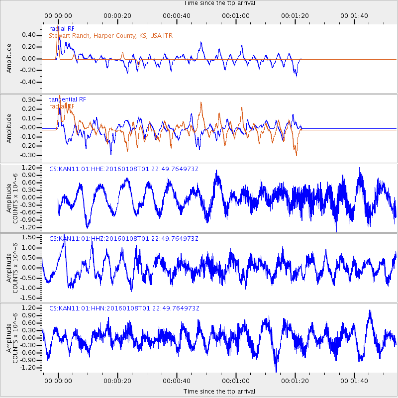
KAN11 Stewart Ranch, Harper County, KS, USA - Earthquake Result Viewer
*The percent match for this event was below the threshold and hence no stack was calculated.
| Earthquake location: |
Near Coast Of Central Chile |
| Earthquake latitude/longitude: |
-30.7/-71.7 |
| Earthquake time(UTC): |
2016/01/08 (008) 01:12:00 GMT |
| Earthquake Depth: |
31 km |
| Earthquake Magnitude: |
5.6 MWR |
| Earthquake Catalog/Contributor: |
NEIC PDE/NEIC COMCAT |
|
| Network: |
GS US Geological Survey Networks |
| Station: |
KAN11 Stewart Ranch, Harper County, KS, USA |
| Lat/Lon: |
37.21 N/97.91 W |
| Elevation: |
410 m |
|
| Distance: |
71.8 deg |
| Az: |
338.194 deg |
| Baz: |
156.366 deg |
| Ray Param: |
$rayparam |
*The percent match for this event was below the threshold and hence was not used in the summary stack. |
|
| Radial Match: |
69.84312 % |
| Radial Bump: |
400 |
| Transverse Match: |
50.421616 % |
| Transverse Bump: |
378 |
| SOD ConfigId: |
1399611 |
| Insert Time: |
2016-01-22 01:19:54.112 +0000 |
| GWidth: |
2.5 |
| Max Bumps: |
400 |
| Tol: |
0.001 |
|
Signal To Noise
| Channel | StoN | STA | LTA |
| GS:KAN11:01:HHZ:20160108T01:22:49.764973Z | 2.7120204 | 7.7400483E-7 | 2.8539787E-7 |
| GS:KAN11:01:HHN:20160108T01:22:49.764973Z | 1.010352 | 2.872213E-7 | 2.8427843E-7 |
| GS:KAN11:01:HHE:20160108T01:22:49.764973Z | 0.98174363 | 4.5956767E-7 | 4.681137E-7 |
| Arrivals |
| Ps | |
| PpPs | |
| PsPs/PpSs | |


