You are here: Home > Network List > TA - USArray Transportable Network (new EarthScope stations) Stations List
> Station Q30A Quinter, KS, USA > Earthquake Result Viewer
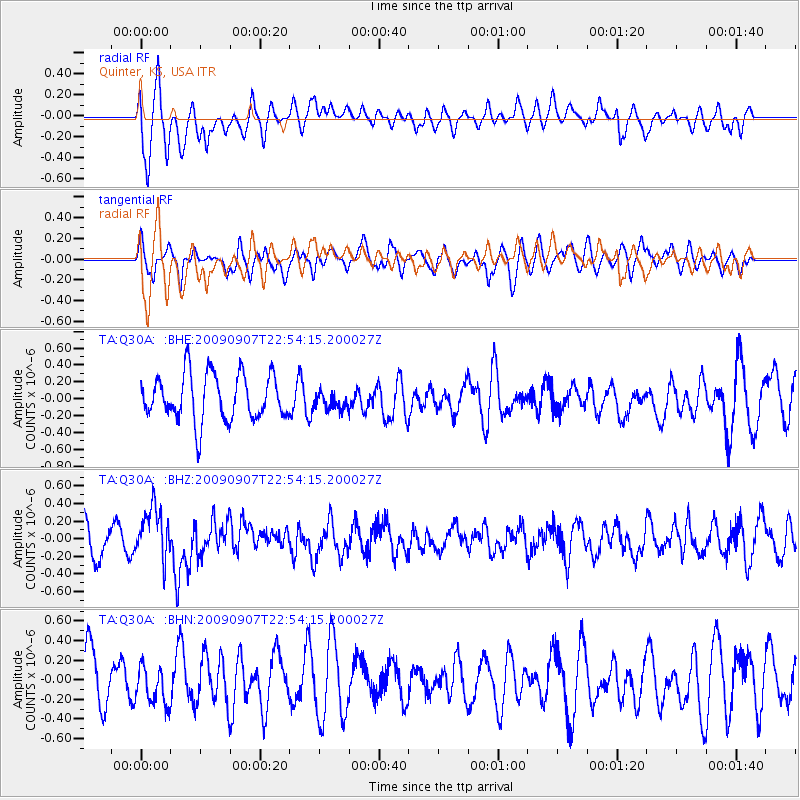
Q30A Quinter, KS, USA - Earthquake Result Viewer
*The percent match for this event was below the threshold and hence no stack was calculated.
| Earthquake location: |
Northwestern Caucasus |
| Earthquake latitude/longitude: |
42.7/43.4 |
| Earthquake time(UTC): |
2009/09/07 (250) 22:41:37 GMT |
| Earthquake Depth: |
15 km |
| Earthquake Magnitude: |
5.7 MB, 5.8 MS, 6.0 MW, 5.9 MW |
| Earthquake Catalog/Contributor: |
WHDF/NEIC |
|
| Network: |
TA USArray Transportable Network (new EarthScope stations) |
| Station: |
Q30A Quinter, KS, USA |
| Lat/Lon: |
38.98 N/100.22 W |
| Elevation: |
797 m |
|
| Distance: |
92.3 deg |
| Az: |
332.47 deg |
| Baz: |
25.94 deg |
| Ray Param: |
$rayparam |
*The percent match for this event was below the threshold and hence was not used in the summary stack. |
|
| Radial Match: |
56.647728 % |
| Radial Bump: |
400 |
| Transverse Match: |
60.507328 % |
| Transverse Bump: |
375 |
| SOD ConfigId: |
2622 |
| Insert Time: |
2010-03-06 01:52:26.386 +0000 |
| GWidth: |
2.5 |
| Max Bumps: |
400 |
| Tol: |
0.001 |
|
Signal To Noise
| Channel | StoN | STA | LTA |
| TA:Q30A: :BHZ:20090907T22:54:15.200027Z | 1.8708203 | 2.8823828E-7 | 1.5407052E-7 |
| TA:Q30A: :BHN:20090907T22:54:15.200027Z | 0.8180335 | 1.9499697E-7 | 2.3837283E-7 |
| TA:Q30A: :BHE:20090907T22:54:15.200027Z | 0.3716784 | 1.0119689E-7 | 2.7227003E-7 |
| Arrivals |
| Ps | |
| PpPs | |
| PsPs/PpSs | |


