You are here: Home > Network List > TA - USArray Transportable Network (new EarthScope stations) Stations List
> Station Q30A Quinter, KS, USA > Earthquake Result Viewer
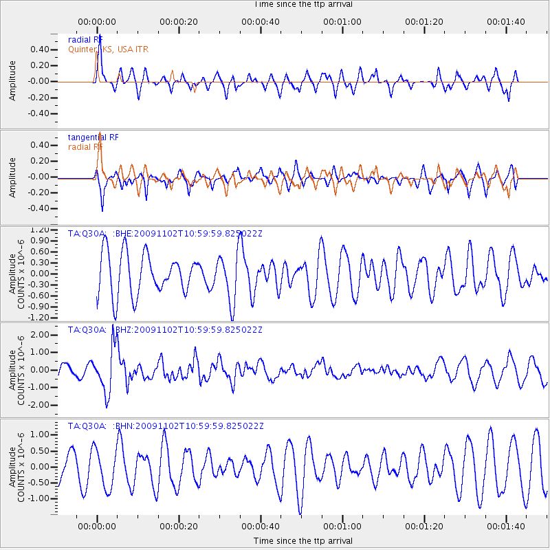
Q30A Quinter, KS, USA - Earthquake Result Viewer
*The percent match for this event was below the threshold and hence no stack was calculated.
| Earthquake location: |
South Of Tonga Islands |
| Earthquake latitude/longitude: |
-24.1/-175.2 |
| Earthquake time(UTC): |
2009/11/02 (306) 10:47:13 GMT |
| Earthquake Depth: |
9.0 km |
| Earthquake Magnitude: |
6.1 MB, 6.1 MS, 6.2 MW, 6.1 MW |
| Earthquake Catalog/Contributor: |
WHDF/NEIC |
|
| Network: |
TA USArray Transportable Network (new EarthScope stations) |
| Station: |
Q30A Quinter, KS, USA |
| Lat/Lon: |
38.98 N/100.22 W |
| Elevation: |
797 m |
|
| Distance: |
94.0 deg |
| Az: |
48.987 deg |
| Baz: |
242.193 deg |
| Ray Param: |
$rayparam |
*The percent match for this event was below the threshold and hence was not used in the summary stack. |
|
| Radial Match: |
77.819046 % |
| Radial Bump: |
400 |
| Transverse Match: |
61.756 % |
| Transverse Bump: |
369 |
| SOD ConfigId: |
2622 |
| Insert Time: |
2010-03-06 01:52:36.758 +0000 |
| GWidth: |
2.5 |
| Max Bumps: |
400 |
| Tol: |
0.001 |
|
Signal To Noise
| Channel | StoN | STA | LTA |
| TA:Q30A: :BHZ:20091102T10:59:59.825022Z | 5.084812 | 1.3087956E-6 | 2.573931E-7 |
| TA:Q30A: :BHN:20091102T10:59:59.825022Z | 1.2934126 | 6.092381E-7 | 4.7103154E-7 |
| TA:Q30A: :BHE:20091102T10:59:59.825022Z | 1.2026504 | 6.782062E-7 | 5.639263E-7 |
| Arrivals |
| Ps | |
| PpPs | |
| PsPs/PpSs | |


