You are here: Home > Network List > AV - Alaska Volcano Observatory Stations List
> Station SPCR Ckakachatna River, Mount Spurr, Alaska > Earthquake Result Viewer
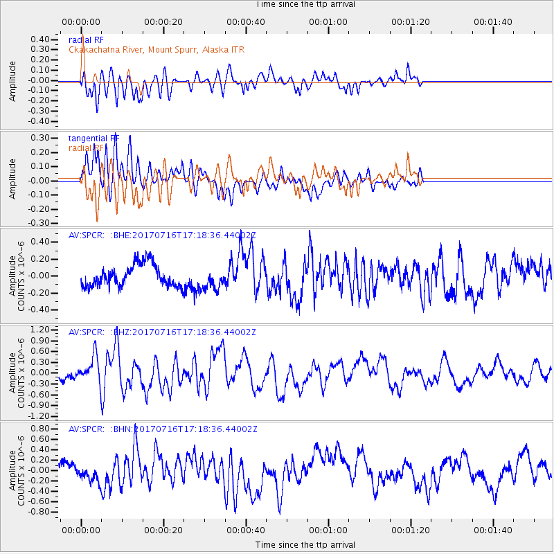
SPCR Ckakachatna River, Mount Spurr, Alaska - Earthquake Result Viewer
*The percent match for this event was below the threshold and hence no stack was calculated.
| Earthquake location: |
Tonga Islands |
| Earthquake latitude/longitude: |
-20.4/-173.5 |
| Earthquake time(UTC): |
2017/07/16 (197) 17:06:41 GMT |
| Earthquake Depth: |
10 km |
| Earthquake Magnitude: |
5.5 Mww |
| Earthquake Catalog/Contributor: |
NEIC PDE/us |
|
| Network: |
AV Alaska Volcano Observatory |
| Station: |
SPCR Ckakachatna River, Mount Spurr, Alaska |
| Lat/Lon: |
61.20 N/152.21 W |
| Elevation: |
984 m |
|
| Distance: |
83.1 deg |
| Az: |
10.179 deg |
| Baz: |
200.014 deg |
| Ray Param: |
$rayparam |
*The percent match for this event was below the threshold and hence was not used in the summary stack. |
|
| Radial Match: |
62.833946 % |
| Radial Bump: |
400 |
| Transverse Match: |
77.26439 % |
| Transverse Bump: |
400 |
| SOD ConfigId: |
13570011 |
| Insert Time: |
2019-04-28 09:31:14.337 +0000 |
| GWidth: |
2.5 |
| Max Bumps: |
400 |
| Tol: |
0.001 |
|
Signal To Noise
| Channel | StoN | STA | LTA |
| AV:SPCR: :BHZ:20170716T17:18:36.44002Z | 2.5772643 | 3.7941925E-7 | 1.4721782E-7 |
| AV:SPCR: :BHN:20170716T17:18:36.44002Z | 0.86911243 | 1.3969307E-7 | 1.6073072E-7 |
| AV:SPCR: :BHE:20170716T17:18:36.44002Z | 1.0699716 | 1.3536024E-7 | 1.2650827E-7 |
| Arrivals |
| Ps | |
| PpPs | |
| PsPs/PpSs | |


