You are here: Home > Network List > TA - USArray Transportable Network (new EarthScope stations) Stations List
> Station D25K Kavik River, AK, USA > Earthquake Result Viewer
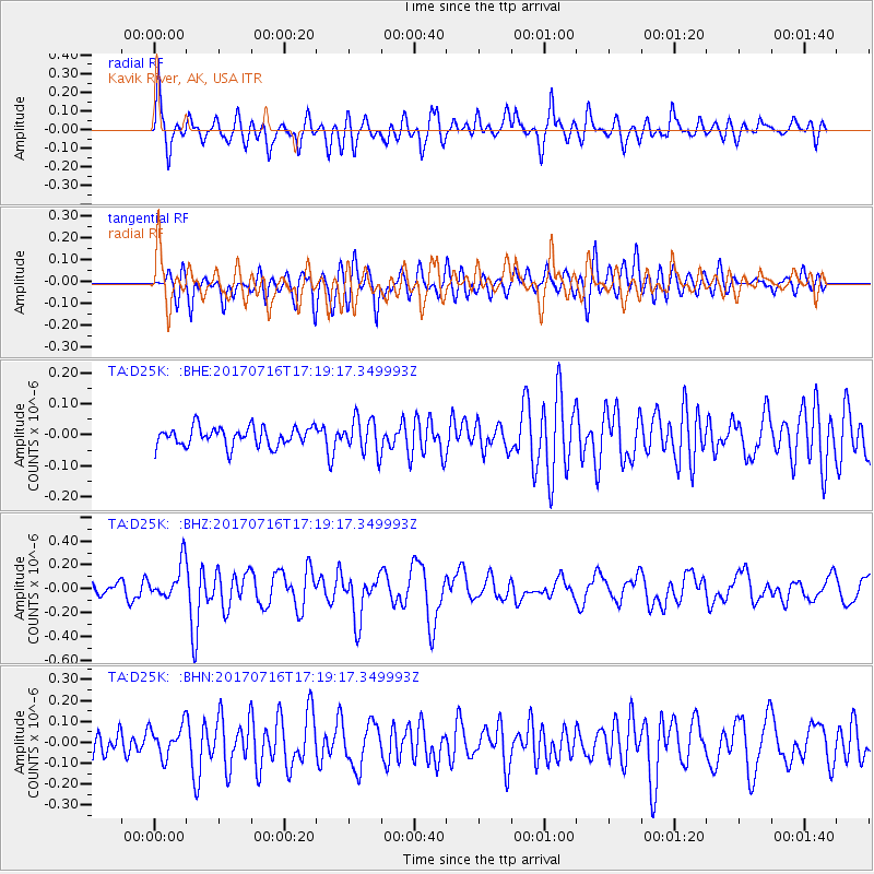
D25K Kavik River, AK, USA - Earthquake Result Viewer
*The percent match for this event was below the threshold and hence no stack was calculated.
| Earthquake location: |
Tonga Islands |
| Earthquake latitude/longitude: |
-20.4/-173.5 |
| Earthquake time(UTC): |
2017/07/16 (197) 17:06:41 GMT |
| Earthquake Depth: |
10 km |
| Earthquake Magnitude: |
5.5 Mww |
| Earthquake Catalog/Contributor: |
NEIC PDE/us |
|
| Network: |
TA USArray Transportable Network (new EarthScope stations) |
| Station: |
D25K Kavik River, AK, USA |
| Lat/Lon: |
69.32 N/146.38 W |
| Elevation: |
770 m |
|
| Distance: |
91.6 deg |
| Az: |
9.308 deg |
| Baz: |
205.281 deg |
| Ray Param: |
$rayparam |
*The percent match for this event was below the threshold and hence was not used in the summary stack. |
|
| Radial Match: |
78.141815 % |
| Radial Bump: |
400 |
| Transverse Match: |
68.73893 % |
| Transverse Bump: |
400 |
| SOD ConfigId: |
13570011 |
| Insert Time: |
2019-04-28 09:35:20.252 +0000 |
| GWidth: |
2.5 |
| Max Bumps: |
400 |
| Tol: |
0.001 |
|
Signal To Noise
| Channel | StoN | STA | LTA |
| TA:D25K: :BHZ:20170716T17:19:17.349993Z | 3.0922058 | 1.5132221E-7 | 4.8936656E-8 |
| TA:D25K: :BHN:20170716T17:19:17.349993Z | 1.6147177 | 7.5808735E-8 | 4.69486E-8 |
| TA:D25K: :BHE:20170716T17:19:17.349993Z | 1.5955893 | 4.8463253E-8 | 3.037326E-8 |
| Arrivals |
| Ps | |
| PpPs | |
| PsPs/PpSs | |


