You are here: Home > Network List > TA - USArray Transportable Network (new EarthScope stations) Stations List
> Station P30A Selden, KS, USA > Earthquake Result Viewer
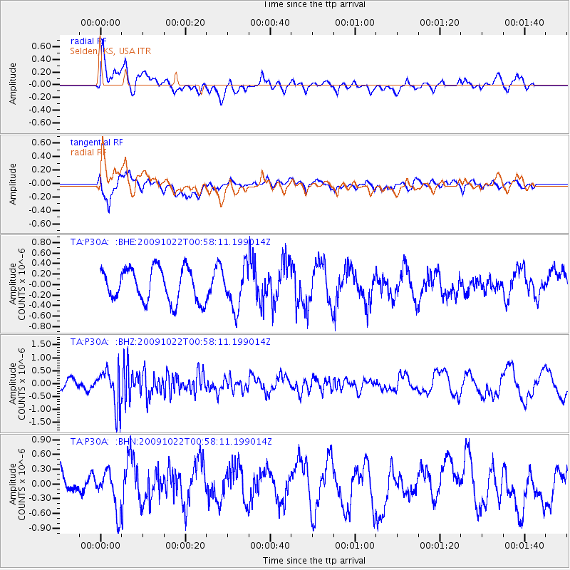
P30A Selden, KS, USA - Earthquake Result Viewer
*The percent match for this event was below the threshold and hence no stack was calculated.
| Earthquake location: |
South Of Panama |
| Earthquake latitude/longitude: |
6.7/-82.6 |
| Earthquake time(UTC): |
2009/10/22 (295) 00:51:39 GMT |
| Earthquake Depth: |
18 km |
| Earthquake Magnitude: |
5.5 MB, 5.4 MS, 5.9 MW, 5.9 MW |
| Earthquake Catalog/Contributor: |
WHDF/NEIC |
|
| Network: |
TA USArray Transportable Network (new EarthScope stations) |
| Station: |
P30A Selden, KS, USA |
| Lat/Lon: |
39.54 N/100.25 W |
| Elevation: |
788 m |
|
| Distance: |
36.3 deg |
| Az: |
336.668 deg |
| Baz: |
149.42 deg |
| Ray Param: |
$rayparam |
*The percent match for this event was below the threshold and hence was not used in the summary stack. |
|
| Radial Match: |
50.22741 % |
| Radial Bump: |
400 |
| Transverse Match: |
66.39473 % |
| Transverse Bump: |
400 |
| SOD ConfigId: |
2622 |
| Insert Time: |
2010-03-06 01:53:27.247 +0000 |
| GWidth: |
2.5 |
| Max Bumps: |
400 |
| Tol: |
0.001 |
|
Signal To Noise
| Channel | StoN | STA | LTA |
| TA:P30A: :BHZ:20091022T00:58:11.199014Z | 3.175773 | 7.439468E-7 | 2.3425693E-7 |
| TA:P30A: :BHN:20091022T00:58:11.199014Z | 1.6934166 | 4.0120935E-7 | 2.36923E-7 |
| TA:P30A: :BHE:20091022T00:58:11.199014Z | 1.2766016 | 3.9489453E-7 | 3.0933262E-7 |
| Arrivals |
| Ps | |
| PpPs | |
| PsPs/PpSs | |


