You are here: Home > Network List > TA - USArray Transportable Network (new EarthScope stations) Stations List
> Station P30A Selden, KS, USA > Earthquake Result Viewer
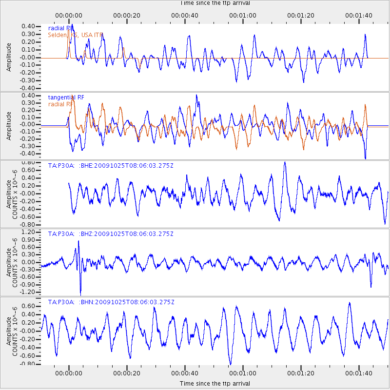
P30A Selden, KS, USA - Earthquake Result Viewer
*The percent match for this event was below the threshold and hence no stack was calculated.
| Earthquake location: |
South Of Fiji Islands |
| Earthquake latitude/longitude: |
-23.1/-179.2 |
| Earthquake time(UTC): |
2009/10/25 (298) 07:53:52 GMT |
| Earthquake Depth: |
418 km |
| Earthquake Magnitude: |
5.6 MB, 6.0 MW, 5.9 MW |
| Earthquake Catalog/Contributor: |
WHDF/NEIC |
|
| Network: |
TA USArray Transportable Network (new EarthScope stations) |
| Station: |
P30A Selden, KS, USA |
| Lat/Lon: |
39.54 N/100.25 W |
| Elevation: |
788 m |
|
| Distance: |
96.4 deg |
| Az: |
49.785 deg |
| Baz: |
245.422 deg |
| Ray Param: |
$rayparam |
*The percent match for this event was below the threshold and hence was not used in the summary stack. |
|
| Radial Match: |
61.2274 % |
| Radial Bump: |
400 |
| Transverse Match: |
46.70592 % |
| Transverse Bump: |
400 |
| SOD ConfigId: |
2622 |
| Insert Time: |
2010-03-06 01:53:29.292 +0000 |
| GWidth: |
2.5 |
| Max Bumps: |
400 |
| Tol: |
0.001 |
|
Signal To Noise
| Channel | StoN | STA | LTA |
| TA:P30A: :BHZ:20091025T08:06:03.275Z | 3.3045018 | 4.0924687E-7 | 1.2384525E-7 |
| TA:P30A: :BHN:20091025T08:06:03.275Z | 0.7167937 | 1.7316066E-7 | 2.415767E-7 |
| TA:P30A: :BHE:20091025T08:06:03.275Z | 0.6869097 | 1.5076871E-7 | 2.194884E-7 |
| Arrivals |
| Ps | |
| PpPs | |
| PsPs/PpSs | |


