You are here: Home > Network List > TA - USArray Transportable Network (new EarthScope stations) Stations List
> Station P30A Selden, KS, USA > Earthquake Result Viewer
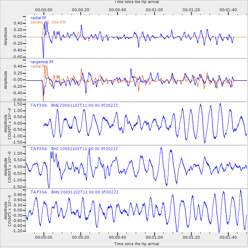
P30A Selden, KS, USA - Earthquake Result Viewer
*The percent match for this event was below the threshold and hence no stack was calculated.
| Earthquake location: |
South Of Tonga Islands |
| Earthquake latitude/longitude: |
-24.1/-175.2 |
| Earthquake time(UTC): |
2009/11/02 (306) 10:47:13 GMT |
| Earthquake Depth: |
9.0 km |
| Earthquake Magnitude: |
6.1 MB, 6.1 MS, 6.2 MW, 6.1 MW |
| Earthquake Catalog/Contributor: |
WHDF/NEIC |
|
| Network: |
TA USArray Transportable Network (new EarthScope stations) |
| Station: |
P30A Selden, KS, USA |
| Lat/Lon: |
39.54 N/100.25 W |
| Elevation: |
788 m |
|
| Distance: |
94.2 deg |
| Az: |
48.476 deg |
| Baz: |
242.213 deg |
| Ray Param: |
$rayparam |
*The percent match for this event was below the threshold and hence was not used in the summary stack. |
|
| Radial Match: |
62.296886 % |
| Radial Bump: |
397 |
| Transverse Match: |
56.665546 % |
| Transverse Bump: |
344 |
| SOD ConfigId: |
2622 |
| Insert Time: |
2010-03-06 01:53:31.287 +0000 |
| GWidth: |
2.5 |
| Max Bumps: |
400 |
| Tol: |
0.001 |
|
Signal To Noise
| Channel | StoN | STA | LTA |
| TA:P30A: :BHZ:20091102T11:00:00.950022Z | 2.8892841 | 7.6867826E-7 | 2.6604454E-7 |
| TA:P30A: :BHN:20091102T11:00:00.950022Z | 0.8947274 | 3.9850468E-7 | 4.453923E-7 |
| TA:P30A: :BHE:20091102T11:00:00.950022Z | 0.8303731 | 4.5539184E-7 | 5.484183E-7 |
| Arrivals |
| Ps | |
| PpPs | |
| PsPs/PpSs | |


