You are here: Home > Network List > CI - Caltech Regional Seismic Network Stations List
> Station SMM Simmler, CA, USA > Earthquake Result Viewer
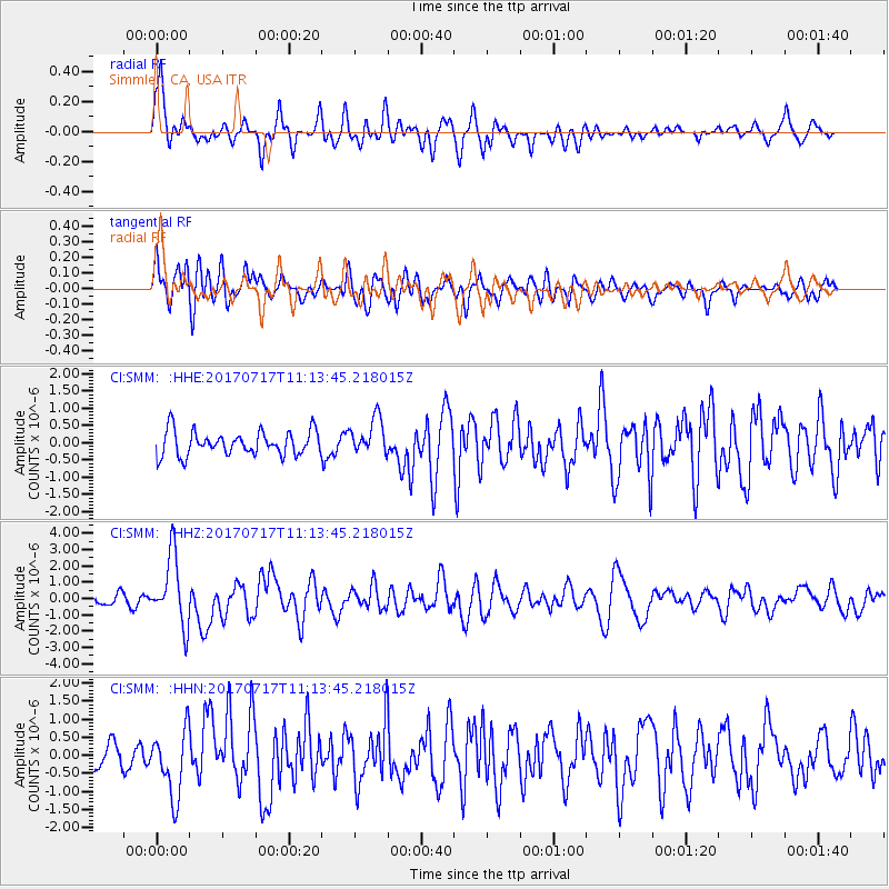
SMM Simmler, CA, USA - Earthquake Result Viewer
*The percent match for this event was below the threshold and hence no stack was calculated.
| Earthquake location: |
Komandorskiye Ostrova Region |
| Earthquake latitude/longitude: |
54.6/168.6 |
| Earthquake time(UTC): |
2017/07/17 (198) 11:05:08 GMT |
| Earthquake Depth: |
7.9 km |
| Earthquake Magnitude: |
6.2 Mww |
| Earthquake Catalog/Contributor: |
NEIC PDE/us |
|
| Network: |
CI Caltech Regional Seismic Network |
| Station: |
SMM Simmler, CA, USA |
| Lat/Lon: |
35.31 N/120.00 W |
| Elevation: |
599 m |
|
| Distance: |
51.7 deg |
| Az: |
81.022 deg |
| Baz: |
315.325 deg |
| Ray Param: |
$rayparam |
*The percent match for this event was below the threshold and hence was not used in the summary stack. |
|
| Radial Match: |
77.32238 % |
| Radial Bump: |
400 |
| Transverse Match: |
74.03267 % |
| Transverse Bump: |
400 |
| SOD ConfigId: |
13570011 |
| Insert Time: |
2019-04-28 09:47:53.270 +0000 |
| GWidth: |
2.5 |
| Max Bumps: |
400 |
| Tol: |
0.001 |
|
Signal To Noise
| Channel | StoN | STA | LTA |
| CI:SMM: :HHZ:20170717T11:13:45.218015Z | 9.409101 | 2.1155804E-6 | 2.2484406E-7 |
| CI:SMM: :HHN:20170717T11:13:45.218015Z | 2.5404873 | 9.192917E-7 | 3.6185648E-7 |
| CI:SMM: :HHE:20170717T11:13:45.218015Z | 1.5102968 | 5.26632E-7 | 3.4869436E-7 |
| Arrivals |
| Ps | |
| PpPs | |
| PsPs/PpSs | |


