You are here: Home > Network List > TA - USArray Transportable Network (new EarthScope stations) Stations List
> Station N28A Pribbeno Ranch, Imperial, NE, USA > Earthquake Result Viewer
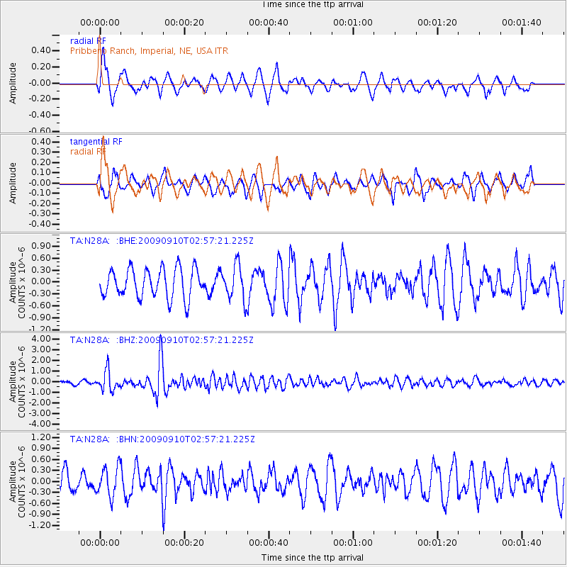
N28A Pribbeno Ranch, Imperial, NE, USA - Earthquake Result Viewer
*The percent match for this event was below the threshold and hence no stack was calculated.
| Earthquake location: |
Kuril Islands |
| Earthquake latitude/longitude: |
48.3/154.2 |
| Earthquake time(UTC): |
2009/09/10 (253) 02:46:50 GMT |
| Earthquake Depth: |
36 km |
| Earthquake Magnitude: |
6.0 MB, 5.5 MS, 6.0 MW, 5.8 MW |
| Earthquake Catalog/Contributor: |
WHDF/NEIC |
|
| Network: |
TA USArray Transportable Network (new EarthScope stations) |
| Station: |
N28A Pribbeno Ranch, Imperial, NE, USA |
| Lat/Lon: |
40.69 N/101.54 W |
| Elevation: |
1009 m |
|
| Distance: |
69.0 deg |
| Az: |
52.134 deg |
| Baz: |
316.135 deg |
| Ray Param: |
$rayparam |
*The percent match for this event was below the threshold and hence was not used in the summary stack. |
|
| Radial Match: |
65.69886 % |
| Radial Bump: |
400 |
| Transverse Match: |
58.49774 % |
| Transverse Bump: |
400 |
| SOD ConfigId: |
2622 |
| Insert Time: |
2010-03-06 01:57:03.819 +0000 |
| GWidth: |
2.5 |
| Max Bumps: |
400 |
| Tol: |
0.001 |
|
Signal To Noise
| Channel | StoN | STA | LTA |
| TA:N28A: :BHZ:20090910T02:57:21.225Z | 9.044261 | 9.450686E-7 | 1.0449374E-7 |
| TA:N28A: :BHN:20090910T02:57:21.225Z | 0.8371616 | 4.0613403E-7 | 4.851322E-7 |
| TA:N28A: :BHE:20090910T02:57:21.225Z | 1.2135838 | 4.41442E-7 | 3.6375073E-7 |
| Arrivals |
| Ps | |
| PpPs | |
| PsPs/PpSs | |


