You are here: Home > Network List > US - United States National Seismic Network Stations List
> Station AMTX Amarillo, Texas, USA > Earthquake Result Viewer
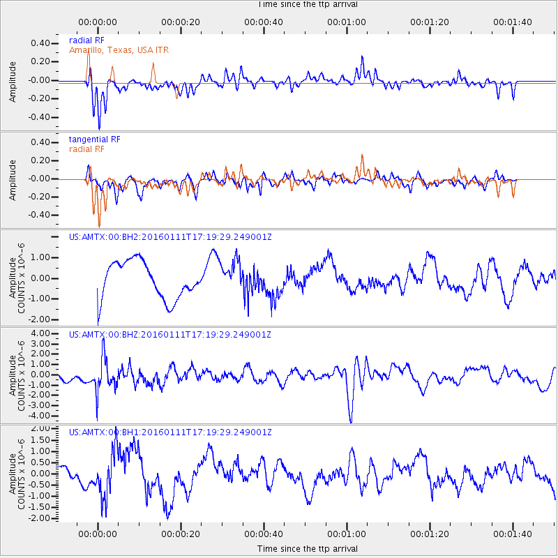
AMTX Amarillo, Texas, USA - Earthquake Result Viewer
*The percent match for this event was below the threshold and hence no stack was calculated.
| Earthquake location: |
Hokkaido, Japan Region |
| Earthquake latitude/longitude: |
44.5/141.1 |
| Earthquake time(UTC): |
2016/01/11 (011) 17:08:03 GMT |
| Earthquake Depth: |
240 km |
| Earthquake Magnitude: |
6.2 MWW |
| Earthquake Catalog/Contributor: |
NEIC PDE/NEIC COMCAT |
|
| Network: |
US United States National Seismic Network |
| Station: |
AMTX Amarillo, Texas, USA |
| Lat/Lon: |
34.53 N/101.41 W |
| Elevation: |
1010 m |
|
| Distance: |
83.1 deg |
| Az: |
47.529 deg |
| Baz: |
320.229 deg |
| Ray Param: |
$rayparam |
*The percent match for this event was below the threshold and hence was not used in the summary stack. |
|
| Radial Match: |
79.0836 % |
| Radial Bump: |
400 |
| Transverse Match: |
65.87081 % |
| Transverse Bump: |
400 |
| SOD ConfigId: |
1399611 |
| Insert Time: |
2016-01-25 17:44:27.235 +0000 |
| GWidth: |
2.5 |
| Max Bumps: |
400 |
| Tol: |
0.001 |
|
Signal To Noise
| Channel | StoN | STA | LTA |
| US:AMTX:00:BHZ:20160111T17:19:29.249001Z | 1.6463592 | 1.6629092E-6 | 1.0100525E-6 |
| US:AMTX:00:BH1:20160111T17:19:29.249001Z | 1.1298797 | 1.0124975E-6 | 8.9611086E-7 |
| US:AMTX:00:BH2:20160111T17:19:29.249001Z | 0.88875604 | 7.3406767E-7 | 8.259496E-7 |
| Arrivals |
| Ps | |
| PpPs | |
| PsPs/PpSs | |


