You are here: Home > Network List > CI - Caltech Regional Seismic Network Stations List
> Station MPP McPhearson Peak > Earthquake Result Viewer
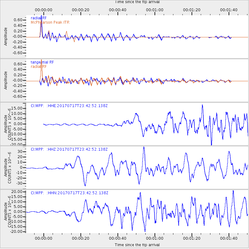
MPP McPhearson Peak - Earthquake Result Viewer
*The percent match for this event was below the threshold and hence no stack was calculated.
| Earthquake location: |
Komandorskiye Ostrova Region |
| Earthquake latitude/longitude: |
54.2/169.2 |
| Earthquake time(UTC): |
2017/07/17 (198) 23:34:21 GMT |
| Earthquake Depth: |
48 km |
| Earthquake Magnitude: |
7.4 Mi |
| Earthquake Catalog/Contributor: |
NEIC PDE/pt |
|
| Network: |
CI Caltech Regional Seismic Network |
| Station: |
MPP McPhearson Peak |
| Lat/Lon: |
34.89 N/119.81 W |
| Elevation: |
1739 m |
|
| Distance: |
51.8 deg |
| Az: |
81.38 deg |
| Baz: |
315.038 deg |
| Ray Param: |
$rayparam |
*The percent match for this event was below the threshold and hence was not used in the summary stack. |
|
| Radial Match: |
96.15273 % |
| Radial Bump: |
400 |
| Transverse Match: |
86.52376 % |
| Transverse Bump: |
400 |
| SOD ConfigId: |
13570011 |
| Insert Time: |
2019-04-28 10:01:06.272 +0000 |
| GWidth: |
2.5 |
| Max Bumps: |
400 |
| Tol: |
0.001 |
|
Signal To Noise
| Channel | StoN | STA | LTA |
| CI:MPP: :HHZ:20170717T23:42:52.138Z | 4.1240406 | 1.5576256E-6 | 3.7769405E-7 |
| CI:MPP: :HHN:20170717T23:42:52.138Z | 2.2238176 | 8.7437405E-7 | 3.9318604E-7 |
| CI:MPP: :HHE:20170717T23:42:52.138Z | 1.2360497 | 5.0864816E-7 | 4.115111E-7 |
| Arrivals |
| Ps | |
| PpPs | |
| PsPs/PpSs | |


