You are here: Home > Network List > US - United States National Seismic Network Stations List
> Station WMOK Wichita Mountains, Oklahoma, USA > Earthquake Result Viewer
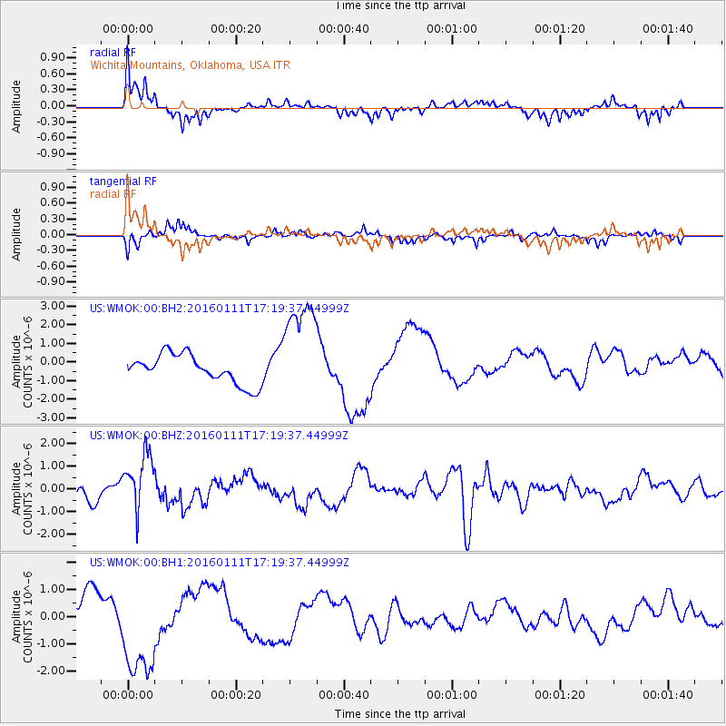
WMOK Wichita Mountains, Oklahoma, USA - Earthquake Result Viewer
*The percent match for this event was below the threshold and hence no stack was calculated.
| Earthquake location: |
Hokkaido, Japan Region |
| Earthquake latitude/longitude: |
44.5/141.1 |
| Earthquake time(UTC): |
2016/01/11 (011) 17:08:03 GMT |
| Earthquake Depth: |
240 km |
| Earthquake Magnitude: |
6.2 MWW |
| Earthquake Catalog/Contributor: |
NEIC PDE/NEIC COMCAT |
|
| Network: |
US United States National Seismic Network |
| Station: |
WMOK Wichita Mountains, Oklahoma, USA |
| Lat/Lon: |
34.74 N/98.78 W |
| Elevation: |
486 m |
|
| Distance: |
84.3 deg |
| Az: |
45.706 deg |
| Baz: |
321.514 deg |
| Ray Param: |
$rayparam |
*The percent match for this event was below the threshold and hence was not used in the summary stack. |
|
| Radial Match: |
68.7677 % |
| Radial Bump: |
363 |
| Transverse Match: |
65.95288 % |
| Transverse Bump: |
339 |
| SOD ConfigId: |
1399611 |
| Insert Time: |
2016-01-25 17:46:47.712 +0000 |
| GWidth: |
2.5 |
| Max Bumps: |
400 |
| Tol: |
0.001 |
|
Signal To Noise
| Channel | StoN | STA | LTA |
| US:WMOK:00:BHZ:20160111T17:19:37.44999Z | 2.3281684 | 1.2813628E-6 | 5.503737E-7 |
| US:WMOK:00:BH1:20160111T17:19:37.44999Z | 3.1661744 | 1.88252E-6 | 5.9457244E-7 |
| US:WMOK:00:BH2:20160111T17:19:37.44999Z | 3.6915586 | 2.864166E-6 | 7.75869E-7 |
| Arrivals |
| Ps | |
| PpPs | |
| PsPs/PpSs | |


