You are here: Home > Network List > TA - USArray Transportable Network (new EarthScope stations) Stations List
> Station K28A Ten Mile Ranch, Cody, NE, USA > Earthquake Result Viewer
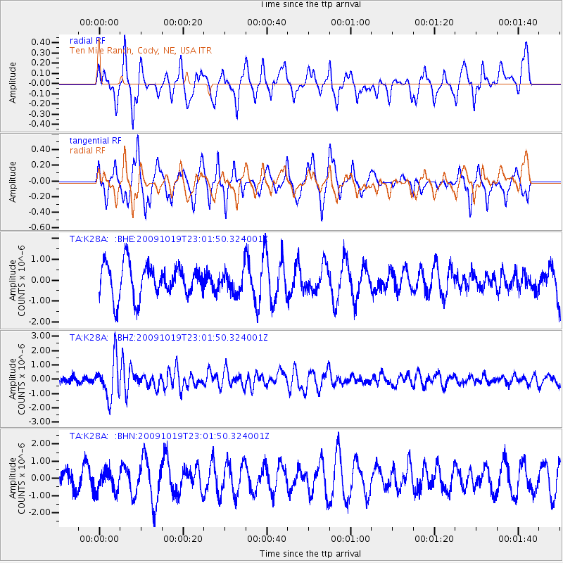
K28A Ten Mile Ranch, Cody, NE, USA - Earthquake Result Viewer
*The percent match for this event was below the threshold and hence no stack was calculated.
| Earthquake location: |
Samoa Islands Region |
| Earthquake latitude/longitude: |
-15.4/-172.3 |
| Earthquake time(UTC): |
2009/10/19 (292) 22:49:38 GMT |
| Earthquake Depth: |
18 km |
| Earthquake Magnitude: |
6.2 MB, 5.7 MS, 6.0 MW, 5.9 MW |
| Earthquake Catalog/Contributor: |
WHDF/NEIC |
|
| Network: |
TA USArray Transportable Network (new EarthScope stations) |
| Station: |
K28A Ten Mile Ranch, Cody, NE, USA |
| Lat/Lon: |
42.71 N/101.37 W |
| Elevation: |
986 m |
|
| Distance: |
86.9 deg |
| Az: |
44.225 deg |
| Baz: |
245.92 deg |
| Ray Param: |
$rayparam |
*The percent match for this event was below the threshold and hence was not used in the summary stack. |
|
| Radial Match: |
50.19348 % |
| Radial Bump: |
353 |
| Transverse Match: |
64.29151 % |
| Transverse Bump: |
343 |
| SOD ConfigId: |
2622 |
| Insert Time: |
2010-03-06 02:01:26.497 +0000 |
| GWidth: |
2.5 |
| Max Bumps: |
400 |
| Tol: |
0.001 |
|
Signal To Noise
| Channel | StoN | STA | LTA |
| TA:K28A: :BHZ:20091019T23:01:50.324001Z | 5.269939 | 1.3762688E-6 | 2.6115458E-7 |
| TA:K28A: :BHN:20091019T23:01:50.324001Z | 1.2920378 | 6.0157504E-7 | 4.6560172E-7 |
| TA:K28A: :BHE:20091019T23:01:50.324001Z | 0.7140835 | 5.588495E-7 | 7.826108E-7 |
| Arrivals |
| Ps | |
| PpPs | |
| PsPs/PpSs | |


