You are here: Home > Network List > TA - USArray Transportable Network (new EarthScope stations) Stations List
> Station K28A Ten Mile Ranch, Cody, NE, USA > Earthquake Result Viewer
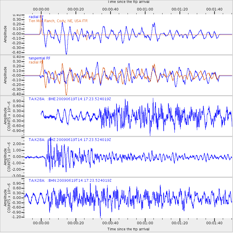
K28A Ten Mile Ranch, Cody, NE, USA - Earthquake Result Viewer
*The percent match for this event was below the threshold and hence no stack was calculated.
| Earthquake location: |
Eastern Mediterranean Sea |
| Earthquake latitude/longitude: |
35.4/28.5 |
| Earthquake time(UTC): |
2009/06/19 (170) 14:04:59 GMT |
| Earthquake Depth: |
28 km |
| Earthquake Magnitude: |
5.6 MB, 5.6 MS, 5.8 MW, 5.8 MW |
| Earthquake Catalog/Contributor: |
WHDF/NEIC |
|
| Network: |
TA USArray Transportable Network (new EarthScope stations) |
| Station: |
K28A Ten Mile Ranch, Cody, NE, USA |
| Lat/Lon: |
42.71 N/101.37 W |
| Elevation: |
986 m |
|
| Distance: |
89.8 deg |
| Az: |
325.522 deg |
| Baz: |
38.888 deg |
| Ray Param: |
$rayparam |
*The percent match for this event was below the threshold and hence was not used in the summary stack. |
|
| Radial Match: |
73.58569 % |
| Radial Bump: |
400 |
| Transverse Match: |
57.63267 % |
| Transverse Bump: |
400 |
| SOD ConfigId: |
2648 |
| Insert Time: |
2010-03-06 02:01:38.498 +0000 |
| GWidth: |
2.5 |
| Max Bumps: |
400 |
| Tol: |
0.001 |
|
Signal To Noise
| Channel | StoN | STA | LTA |
| TA:K28A: :BHZ:20090619T14:17:23.524019Z | 7.0214944 | 7.0907555E-7 | 1.0098641E-7 |
| TA:K28A: :BHN:20090619T14:17:23.524019Z | 1.3796939 | 2.6659978E-7 | 1.9323112E-7 |
| TA:K28A: :BHE:20090619T14:17:23.524019Z | 0.916063 | 1.8675291E-7 | 2.038647E-7 |
| Arrivals |
| Ps | |
| PpPs | |
| PsPs/PpSs | |


