You are here: Home > Network List > UW - Pacific Northwest Regional Seismic Network Stations List
> Station UMAT Pilot Rock, OR, USA > Earthquake Result Viewer
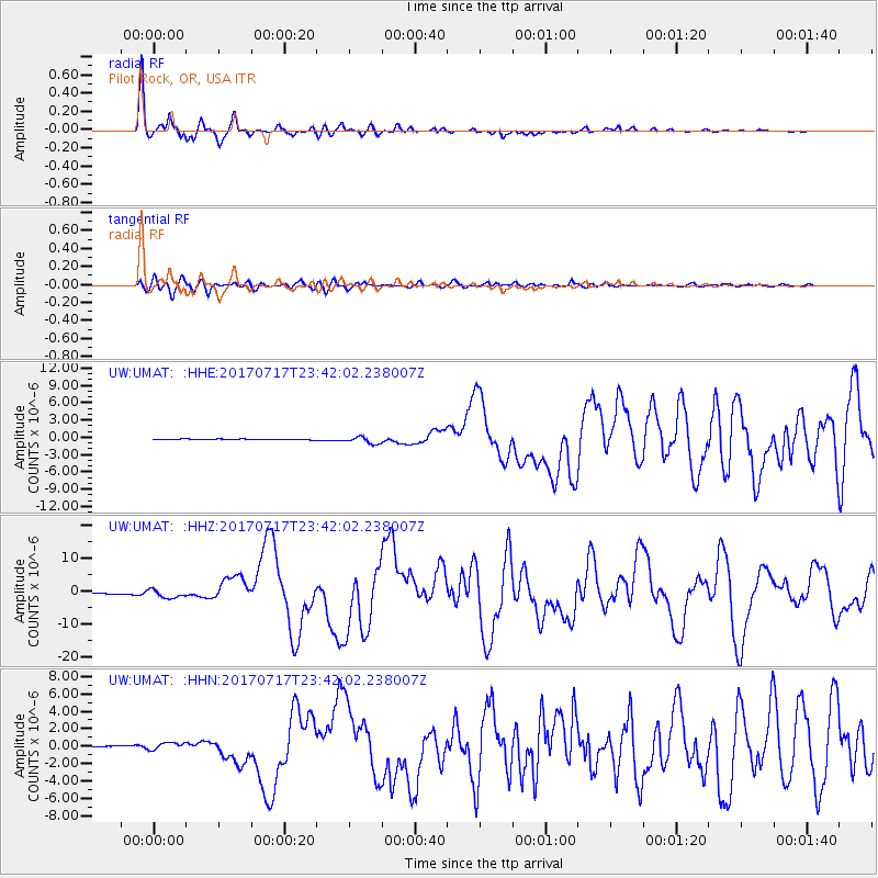
UMAT Pilot Rock, OR, USA - Earthquake Result Viewer
*The percent match for this event was below the threshold and hence no stack was calculated.
| Earthquake location: |
Komandorskiye Ostrova Region |
| Earthquake latitude/longitude: |
54.2/169.2 |
| Earthquake time(UTC): |
2017/07/17 (198) 23:34:21 GMT |
| Earthquake Depth: |
48 km |
| Earthquake Magnitude: |
7.4 Mi |
| Earthquake Catalog/Contributor: |
NEIC PDE/pt |
|
| Network: |
UW Pacific Northwest Regional Seismic Network |
| Station: |
UMAT Pilot Rock, OR, USA |
| Lat/Lon: |
45.29 N/118.96 W |
| Elevation: |
1318 m |
|
| Distance: |
45.4 deg |
| Az: |
70.453 deg |
| Baz: |
308.338 deg |
| Ray Param: |
$rayparam |
*The percent match for this event was below the threshold and hence was not used in the summary stack. |
|
| Radial Match: |
97.47729 % |
| Radial Bump: |
343 |
| Transverse Match: |
86.98451 % |
| Transverse Bump: |
400 |
| SOD ConfigId: |
13570011 |
| Insert Time: |
2019-04-28 10:10:19.188 +0000 |
| GWidth: |
2.5 |
| Max Bumps: |
400 |
| Tol: |
0.001 |
|
Signal To Noise
| Channel | StoN | STA | LTA |
| UW:UMAT: :HHZ:20170717T23:42:02.238007Z | 7.245069 | 1.3375233E-6 | 1.8461154E-7 |
| UW:UMAT: :HHN:20170717T23:42:02.238007Z | 6.955469 | 4.198599E-7 | 6.0363995E-8 |
| UW:UMAT: :HHE:20170717T23:42:02.238007Z | 7.5967083 | 5.932567E-7 | 7.809391E-8 |
| Arrivals |
| Ps | |
| PpPs | |
| PsPs/PpSs | |


