You are here: Home > Network List > G - GEOSCOPE Stations List
> Station INU Inuyama, Japan > Earthquake Result Viewer
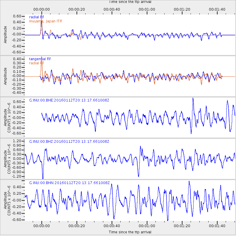
INU Inuyama, Japan - Earthquake Result Viewer
*The percent match for this event was below the threshold and hence no stack was calculated.
| Earthquake location: |
Hindu Kush Region, Afghanistan |
| Earthquake latitude/longitude: |
36.6/71.0 |
| Earthquake time(UTC): |
2016/01/12 (012) 20:04:59 GMT |
| Earthquake Depth: |
239 km |
| Earthquake Magnitude: |
5.7 MWW, 5.7 MWB, 5.7 MWC |
| Earthquake Catalog/Contributor: |
NEIC PDE/NEIC COMCAT |
|
| Network: |
G GEOSCOPE |
| Station: |
INU Inuyama, Japan |
| Lat/Lon: |
35.35 N/137.03 E |
| Elevation: |
132 m |
|
| Distance: |
52.5 deg |
| Az: |
70.337 deg |
| Baz: |
291.973 deg |
| Ray Param: |
$rayparam |
*The percent match for this event was below the threshold and hence was not used in the summary stack. |
|
| Radial Match: |
60.160378 % |
| Radial Bump: |
400 |
| Transverse Match: |
53.070877 % |
| Transverse Bump: |
400 |
| SOD ConfigId: |
1399611 |
| Insert Time: |
2016-01-26 20:15:45.390 +0000 |
| GWidth: |
2.5 |
| Max Bumps: |
400 |
| Tol: |
0.001 |
|
Signal To Noise
| Channel | StoN | STA | LTA |
| G:INU:00:BHZ:20160112T20:13:17.661008Z | 2.3963242 | 5.169851E-7 | 2.1574088E-7 |
| G:INU:00:BHN:20160112T20:13:17.661008Z | 1.1887755 | 1.9731249E-7 | 1.6597961E-7 |
| G:INU:00:BHE:20160112T20:13:17.661008Z | 1.7632487 | 2.1897729E-7 | 1.2418968E-7 |
| Arrivals |
| Ps | |
| PpPs | |
| PsPs/PpSs | |


