You are here: Home > Network List > CI - Caltech Regional Seismic Network Stations List
> Station SMM Simmler, CA, USA > Earthquake Result Viewer
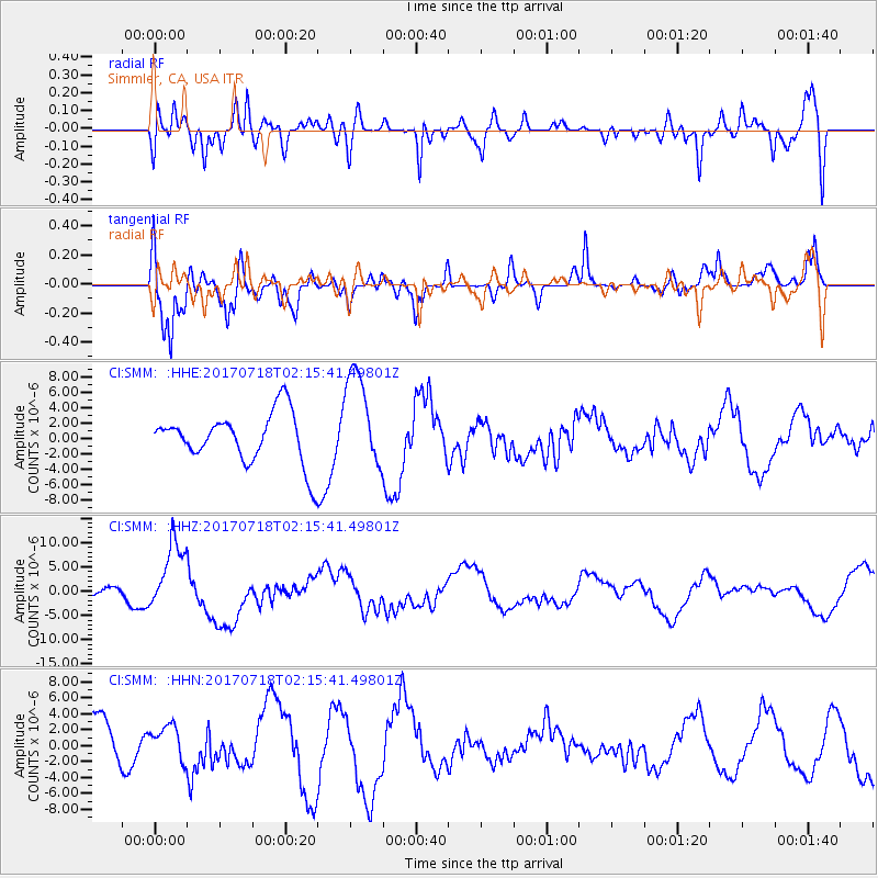
SMM Simmler, CA, USA - Earthquake Result Viewer
*The percent match for this event was below the threshold and hence no stack was calculated.
| Earthquake location: |
Near Coast Of Peru |
| Earthquake latitude/longitude: |
-16.4/-73.6 |
| Earthquake time(UTC): |
2017/07/18 (199) 02:05:19 GMT |
| Earthquake Depth: |
44 km |
| Earthquake Magnitude: |
6.4 Mww |
| Earthquake Catalog/Contributor: |
NEIC PDE/us |
|
| Network: |
CI Caltech Regional Seismic Network |
| Station: |
SMM Simmler, CA, USA |
| Lat/Lon: |
35.31 N/120.00 W |
| Elevation: |
599 m |
|
| Distance: |
67.7 deg |
| Az: |
320.196 deg |
| Baz: |
131.295 deg |
| Ray Param: |
$rayparam |
*The percent match for this event was below the threshold and hence was not used in the summary stack. |
|
| Radial Match: |
59.884575 % |
| Radial Bump: |
400 |
| Transverse Match: |
59.742184 % |
| Transverse Bump: |
400 |
| SOD ConfigId: |
13570011 |
| Insert Time: |
2019-04-28 10:13:01.195 +0000 |
| GWidth: |
2.5 |
| Max Bumps: |
400 |
| Tol: |
0.001 |
|
Signal To Noise
| Channel | StoN | STA | LTA |
| CI:SMM: :HHZ:20170718T02:15:41.49801Z | 4.8699474 | 7.2107446E-6 | 1.4806617E-6 |
| CI:SMM: :HHN:20170718T02:15:41.49801Z | 0.6366367 | 2.1689402E-6 | 3.4068728E-6 |
| CI:SMM: :HHE:20170718T02:15:41.49801Z | 1.9210619 | 6.3109815E-6 | 3.2851528E-6 |
| Arrivals |
| Ps | |
| PpPs | |
| PsPs/PpSs | |


