You are here: Home > Network List > II - Global Seismograph Network (GSN - IRIS/IDA) Stations List
> Station WRAB Tennant Creek, NT, Australia > Earthquake Result Viewer
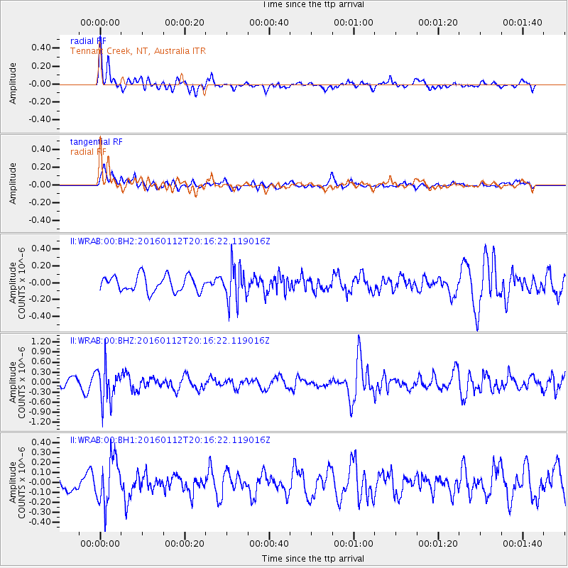
WRAB Tennant Creek, NT, Australia - Earthquake Result Viewer
*The percent match for this event was below the threshold and hence no stack was calculated.
| Earthquake location: |
Hindu Kush Region, Afghanistan |
| Earthquake latitude/longitude: |
36.6/71.0 |
| Earthquake time(UTC): |
2016/01/12 (012) 20:04:59 GMT |
| Earthquake Depth: |
239 km |
| Earthquake Magnitude: |
5.7 MWW, 5.7 MWB, 5.7 MWC |
| Earthquake Catalog/Contributor: |
NEIC PDE/NEIC COMCAT |
|
| Network: |
II Global Seismograph Network (GSN - IRIS/IDA) |
| Station: |
WRAB Tennant Creek, NT, Australia |
| Lat/Lon: |
19.93 S/134.36 E |
| Elevation: |
366 m |
|
| Distance: |
82.1 deg |
| Az: |
121.854 deg |
| Baz: |
313.382 deg |
| Ray Param: |
$rayparam |
*The percent match for this event was below the threshold and hence was not used in the summary stack. |
|
| Radial Match: |
65.61819 % |
| Radial Bump: |
400 |
| Transverse Match: |
46.9992 % |
| Transverse Bump: |
400 |
| SOD ConfigId: |
1399611 |
| Insert Time: |
2016-01-26 20:18:41.865 +0000 |
| GWidth: |
2.5 |
| Max Bumps: |
400 |
| Tol: |
0.001 |
|
Signal To Noise
| Channel | StoN | STA | LTA |
| II:WRAB:00:BHZ:20160112T20:16:22.119016Z | 4.490807 | 5.176155E-7 | 1.1526112E-7 |
| II:WRAB:00:BH1:20160112T20:16:22.119016Z | 3.3519468 | 2.3220365E-7 | 6.9274265E-8 |
| II:WRAB:00:BH2:20160112T20:16:22.119016Z | 2.2204986 | 2.0978838E-7 | 9.4478054E-8 |
| Arrivals |
| Ps | |
| PpPs | |
| PsPs/PpSs | |


