You are here: Home > Network List > TA - USArray Transportable Network (new EarthScope stations) Stations List
> Station F26K Sheenjek River, AK, USA > Earthquake Result Viewer
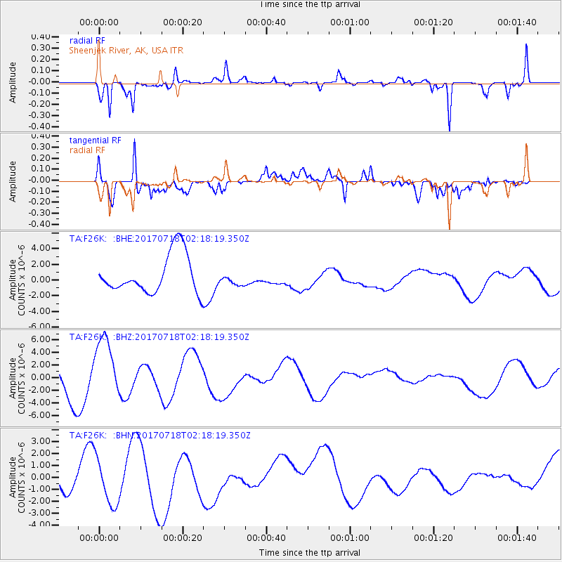
F26K Sheenjek River, AK, USA - Earthquake Result Viewer
*The percent match for this event was below the threshold and hence no stack was calculated.
| Earthquake location: |
Near Coast Of Peru |
| Earthquake latitude/longitude: |
-16.4/-73.6 |
| Earthquake time(UTC): |
2017/07/18 (199) 02:05:19 GMT |
| Earthquake Depth: |
44 km |
| Earthquake Magnitude: |
6.4 Mww |
| Earthquake Catalog/Contributor: |
NEIC PDE/us |
|
| Network: |
TA USArray Transportable Network (new EarthScope stations) |
| Station: |
F26K Sheenjek River, AK, USA |
| Lat/Lon: |
67.69 N/144.15 W |
| Elevation: |
683 m |
|
| Distance: |
97.9 deg |
| Az: |
338.693 deg |
| Baz: |
113.984 deg |
| Ray Param: |
$rayparam |
*The percent match for this event was below the threshold and hence was not used in the summary stack. |
|
| Radial Match: |
73.6376 % |
| Radial Bump: |
290 |
| Transverse Match: |
73.06398 % |
| Transverse Bump: |
400 |
| SOD ConfigId: |
13570011 |
| Insert Time: |
2019-04-28 10:17:29.320 +0000 |
| GWidth: |
2.5 |
| Max Bumps: |
400 |
| Tol: |
0.001 |
|
Signal To Noise
| Channel | StoN | STA | LTA |
| TA:F26K: :BHZ:20170718T02:18:19.350Z | 2.340735 | 5.404224E-6 | 2.3087723E-6 |
| TA:F26K: :BHN:20170718T02:18:19.350Z | 1.2270864 | 2.0648486E-6 | 1.6827246E-6 |
| TA:F26K: :BHE:20170718T02:18:19.350Z | 0.34056616 | 8.369644E-7 | 2.4575677E-6 |
| Arrivals |
| Ps | |
| PpPs | |
| PsPs/PpSs | |


