You are here: Home > Network List > TA - USArray Transportable Network (new EarthScope stations) Stations List
> Station WHTX Lake Whitney, Meridian, TX, USA > Earthquake Result Viewer
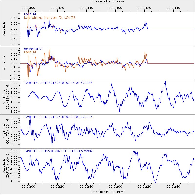
WHTX Lake Whitney, Meridian, TX, USA - Earthquake Result Viewer
*The percent match for this event was below the threshold and hence no stack was calculated.
| Earthquake location: |
Near Coast Of Peru |
| Earthquake latitude/longitude: |
-16.4/-73.6 |
| Earthquake time(UTC): |
2017/07/18 (199) 02:05:19 GMT |
| Earthquake Depth: |
44 km |
| Earthquake Magnitude: |
6.4 Mww |
| Earthquake Catalog/Contributor: |
NEIC PDE/us |
|
| Network: |
TA USArray Transportable Network (new EarthScope stations) |
| Station: |
WHTX Lake Whitney, Meridian, TX, USA |
| Lat/Lon: |
31.99 N/97.46 W |
| Elevation: |
190 m |
|
| Distance: |
53.3 deg |
| Az: |
334.614 deg |
| Baz: |
151.036 deg |
| Ray Param: |
$rayparam |
*The percent match for this event was below the threshold and hence was not used in the summary stack. |
|
| Radial Match: |
51.56256 % |
| Radial Bump: |
400 |
| Transverse Match: |
62.886833 % |
| Transverse Bump: |
265 |
| SOD ConfigId: |
13570011 |
| Insert Time: |
2019-04-28 10:17:51.908 +0000 |
| GWidth: |
2.5 |
| Max Bumps: |
400 |
| Tol: |
0.001 |
|
Signal To Noise
| Channel | StoN | STA | LTA |
| TA:WHTX: :HHZ:20170718T02:14:03.57998Z | 3.1363933 | 2.8245188E-6 | 9.0056267E-7 |
| TA:WHTX: :HHN:20170718T02:14:03.57998Z | 0.96816987 | 1.127838E-6 | 1.1649174E-6 |
| TA:WHTX: :HHE:20170718T02:14:03.57998Z | 1.1516516 | 8.5651214E-7 | 7.4372497E-7 |
| Arrivals |
| Ps | |
| PpPs | |
| PsPs/PpSs | |


