P29A Atwood, KS, USA - Earthquake Result Viewer
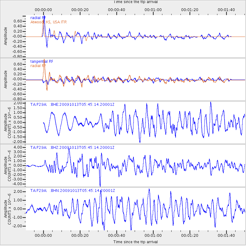
Earthquake location: Fox Islands, Aleutian Islands
Earthquake latitude/longitude: 52.8/-167.0
Earthquake time(UTC): 2009/10/13 (286) 05:37:23 GMT
Earthquake Depth: 24 km
Earthquake Magnitude: 6.0 MB, 6.1 MS, 6.5 MW, 6.5 MW
Earthquake Catalog/Contributor: WHDF/NEIC
Network: TA USArray Transportable Network (new EarthScope stations)
Station: P29A Atwood, KS, USA
Lat/Lon: 39.60 N/100.93 W
Elevation: 929 m
Distance: 46.0 deg
Az: 79.019 deg
Baz: 309.437 deg
Ray Param: 0.07087967
Estimated Moho Depth: 35.0 km
Estimated Crust Vp/Vs: 1.61
Assumed Crust Vp: 6.483 km/s
Estimated Crust Vs: 4.026 km/s
Estimated Crust Poisson's Ratio: 0.19
Radial Match: 89.56748 %
Radial Bump: 356
Transverse Match: 60.882202 %
Transverse Bump: 400
SOD ConfigId: 2622
Insert Time: 2010-03-06 02:03:33.204 +0000
GWidth: 2.5
Max Bumps: 400
Tol: 0.001

Signal To Noise

ChannelStoNSTALTA
TA:P29A: :BHZ:20091013T05:45:14.20001Z1.41935286.2639396E-74.4132364E-7
TA:P29A: :BHN:20091013T05:45:14.20001Z0.78615592.9046421E-73.694741E-7
TA:P29A: :BHE:20091013T05:45:14.20001Z0.83920595.114264E-76.09417E-7
Arrivals
Ps3.5 SECOND
PpPs13 SECOND
PsPs/PpSs17 SECOND