You are here: Home > Network List > UW - Pacific Northwest Regional Seismic Network Stations List
> Station MRBL Marblemount, WA, USA > Earthquake Result Viewer
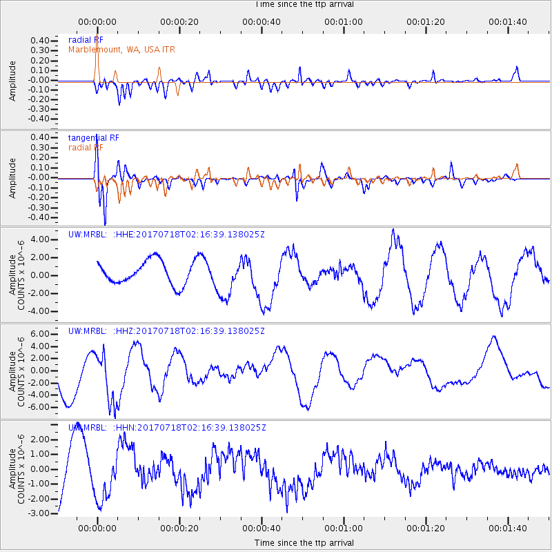
MRBL Marblemount, WA, USA - Earthquake Result Viewer
*The percent match for this event was below the threshold and hence no stack was calculated.
| Earthquake location: |
Near Coast Of Peru |
| Earthquake latitude/longitude: |
-16.4/-73.6 |
| Earthquake time(UTC): |
2017/07/18 (199) 02:05:19 GMT |
| Earthquake Depth: |
44 km |
| Earthquake Magnitude: |
6.4 Mww |
| Earthquake Catalog/Contributor: |
NEIC PDE/us |
|
| Network: |
UW Pacific Northwest Regional Seismic Network |
| Station: |
MRBL Marblemount, WA, USA |
| Lat/Lon: |
48.52 N/121.48 W |
| Elevation: |
75 m |
|
| Distance: |
77.4 deg |
| Az: |
329.644 deg |
| Baz: |
133.15 deg |
| Ray Param: |
$rayparam |
*The percent match for this event was below the threshold and hence was not used in the summary stack. |
|
| Radial Match: |
80.32795 % |
| Radial Bump: |
400 |
| Transverse Match: |
70.7859 % |
| Transverse Bump: |
400 |
| SOD ConfigId: |
13570011 |
| Insert Time: |
2019-04-28 10:18:27.925 +0000 |
| GWidth: |
2.5 |
| Max Bumps: |
400 |
| Tol: |
0.001 |
|
Signal To Noise
| Channel | StoN | STA | LTA |
| UW:MRBL: :HHZ:20170718T02:16:39.138025Z | 1.4626708 | 4.2300267E-6 | 2.891988E-6 |
| UW:MRBL: :HHN:20170718T02:16:39.138025Z | 1.0025285 | 1.6247851E-6 | 1.620687E-6 |
| UW:MRBL: :HHE:20170718T02:16:39.138025Z | 1.7411786 | 2.2593097E-6 | 1.297575E-6 |
| Arrivals |
| Ps | |
| PpPs | |
| PsPs/PpSs | |


