
R31A Burdett, KS, USA - Earthquake Result Viewer
| ||||||||||||||||||
| ||||||||||||||||||
| ||||||||||||||||||
|
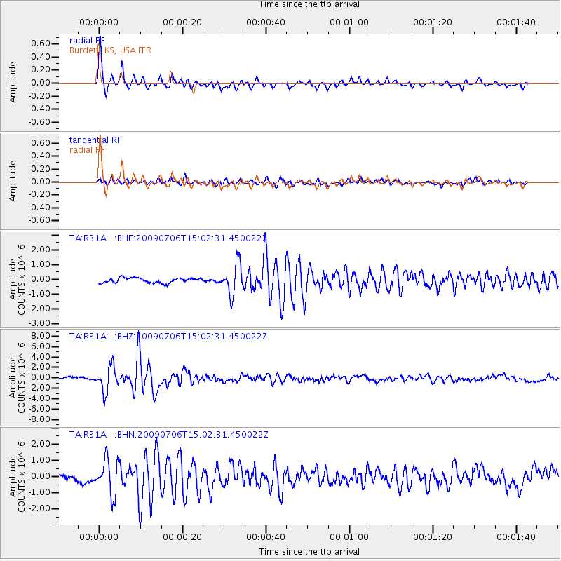
Signal To Noise
| Channel | StoN | STA | LTA |
| TA:R31A: :BHZ:20090706T15:02:31.450022Z | 16.06515 | 2.4020906E-6 | 1.4952182E-7 |
| TA:R31A: :BHN:20090706T15:02:31.450022Z | 8.049496 | 1.0849238E-6 | 1.3478159E-7 |
| TA:R31A: :BHE:20090706T15:02:31.450022Z | 6.3636446 | 1.0499356E-6 | 1.6498966E-7 |
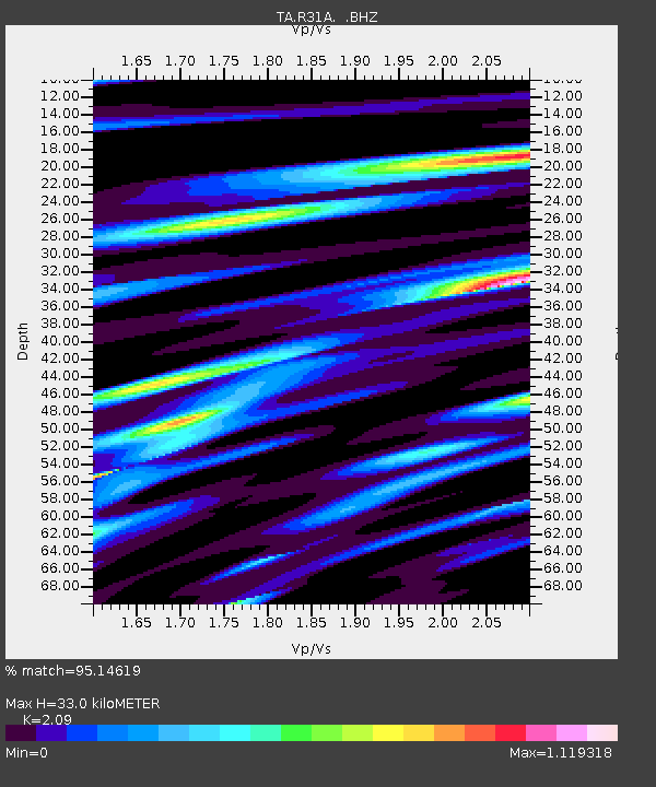
| Arrivals | |
| Ps | 5.8 SECOND |
| PpPs | 15 SECOND |
| PsPs/PpSs | 21 SECOND |

