You are here: Home > Network List > TA - USArray Transportable Network (new EarthScope stations) Stations List
> Station BGNE Belgrade, NE, USA > Earthquake Result Viewer
BGNE Belgrade, NE, USA - Earthquake Result Viewer
*The percent match for this event was below the threshold and hence no stack was calculated.
| Earthquake location: |
Near East Coast Of Honshu, Japan |
| Earthquake latitude/longitude: |
37.4/141.6 |
| Earthquake time(UTC): |
2017/07/20 (201) 00:11:25 GMT |
| Earthquake Depth: |
35 km |
| Earthquake Magnitude: |
5.8 Mww |
| Earthquake Catalog/Contributor: |
NEIC PDE/us |
|
| Network: |
TA USArray Transportable Network (new EarthScope stations) |
| Station: |
BGNE Belgrade, NE, USA |
| Lat/Lon: |
41.41 N/98.15 W |
| Elevation: |
573 m |
|
| Distance: |
84.4 deg |
| Az: |
40.755 deg |
| Baz: |
316.296 deg |
| Ray Param: |
$rayparam |
*The percent match for this event was below the threshold and hence was not used in the summary stack. |
|
| Radial Match: |
56.105568 % |
| Radial Bump: |
400 |
| Transverse Match: |
65.83835 % |
| Transverse Bump: |
400 |
| SOD ConfigId: |
13570011 |
| Insert Time: |
2019-04-28 10:32:57.232 +0000 |
| GWidth: |
2.5 |
| Max Bumps: |
400 |
| Tol: |
0.001 |
|
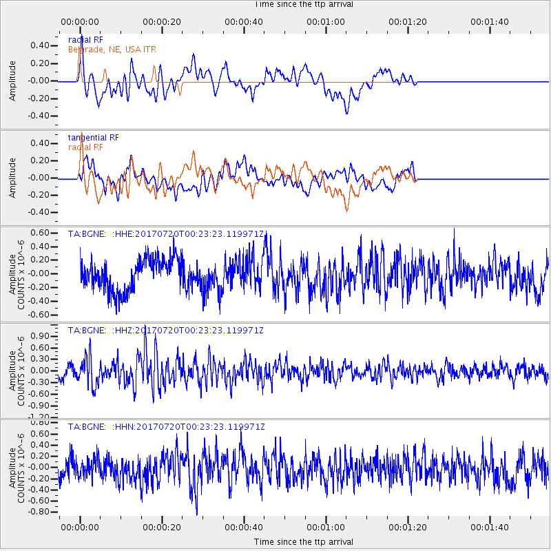
Signal To Noise
| Channel | StoN | STA | LTA |
| TA:BGNE: :HHZ:20170720T00:23:23.119971Z | 3.169641 | 3.6693842E-7 | 1.15766554E-7 |
| TA:BGNE: :HHN:20170720T00:23:23.119971Z | 1.0193474 | 1.5253224E-7 | 1.4963715E-7 |
| TA:BGNE: :HHE:20170720T00:23:23.119971Z | 1.0569395 | 2.4031772E-7 | 2.2737132E-7 |
| Arrivals |
| Ps | |
| PpPs | |
| PsPs/PpSs | |


