You are here: Home > Network List > TA - USArray Transportable Network (new EarthScope stations) Stations List
> Station R31A Burdett, KS, USA > Earthquake Result Viewer
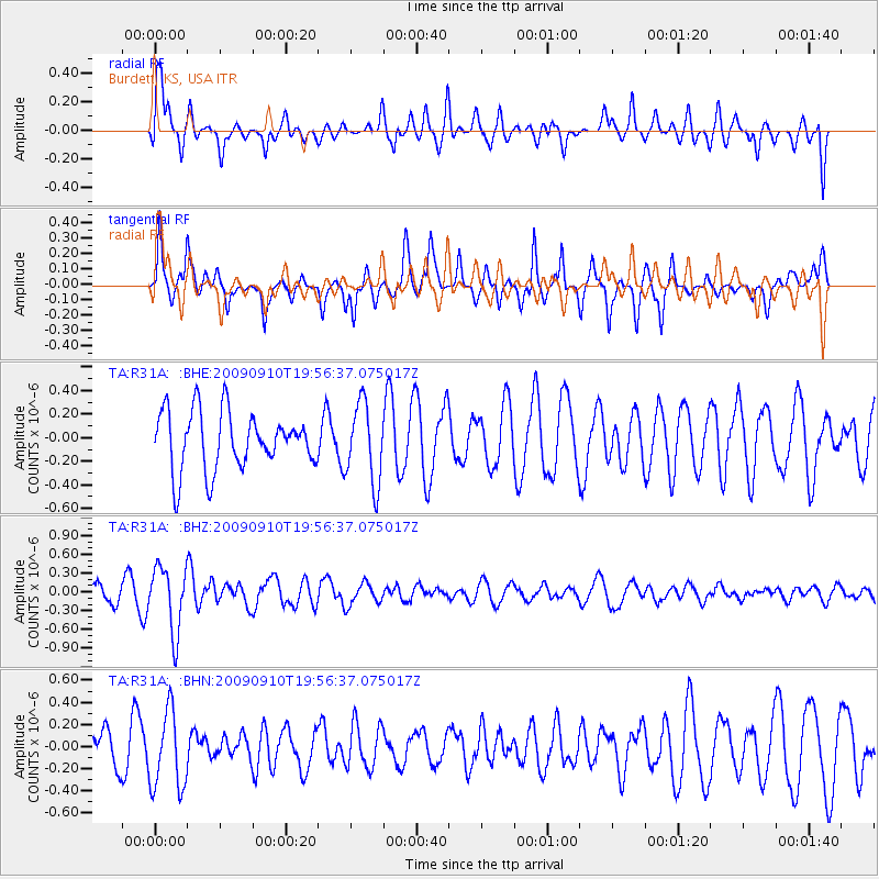
R31A Burdett, KS, USA - Earthquake Result Viewer
*The percent match for this event was below the threshold and hence no stack was calculated.
| Earthquake location: |
Easter Island Region |
| Earthquake latitude/longitude: |
-29.9/-111.8 |
| Earthquake time(UTC): |
2009/09/10 (253) 19:46:03 GMT |
| Earthquake Depth: |
10 km |
| Earthquake Magnitude: |
5.5 MW, 5.4 MB |
| Earthquake Catalog/Contributor: |
WHDF/NEIC |
|
| Network: |
TA USArray Transportable Network (new EarthScope stations) |
| Station: |
R31A Burdett, KS, USA |
| Lat/Lon: |
38.29 N/99.53 W |
| Elevation: |
667 m |
|
| Distance: |
68.8 deg |
| Az: |
10.354 deg |
| Baz: |
191.436 deg |
| Ray Param: |
$rayparam |
*The percent match for this event was below the threshold and hence was not used in the summary stack. |
|
| Radial Match: |
63.00919 % |
| Radial Bump: |
400 |
| Transverse Match: |
73.14516 % |
| Transverse Bump: |
336 |
| SOD ConfigId: |
2622 |
| Insert Time: |
2010-03-06 02:05:42.840 +0000 |
| GWidth: |
2.5 |
| Max Bumps: |
400 |
| Tol: |
0.001 |
|
Signal To Noise
| Channel | StoN | STA | LTA |
| TA:R31A: :BHZ:20090910T19:56:37.075017Z | 4.716068 | 5.1918806E-7 | 1.10089175E-7 |
| TA:R31A: :BHN:20090910T19:56:37.075017Z | 2.92923 | 3.552722E-7 | 1.2128518E-7 |
| TA:R31A: :BHE:20090910T19:56:37.075017Z | 1.374488 | 3.3593588E-7 | 2.4440803E-7 |
| Arrivals |
| Ps | |
| PpPs | |
| PsPs/PpSs | |


