You are here: Home > Network List > TA - USArray Transportable Network (new EarthScope stations) Stations List
> Station L15K Ungalak Mountain, AK, USA > Earthquake Result Viewer
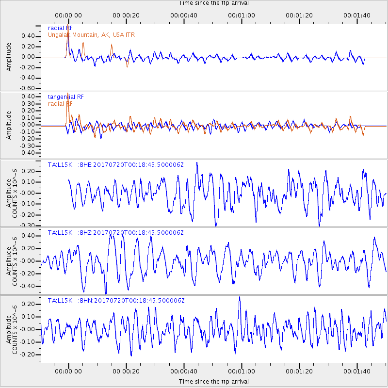
L15K Ungalak Mountain, AK, USA - Earthquake Result Viewer
*The percent match for this event was below the threshold and hence no stack was calculated.
| Earthquake location: |
Near East Coast Of Honshu, Japan |
| Earthquake latitude/longitude: |
37.4/141.6 |
| Earthquake time(UTC): |
2017/07/20 (201) 00:11:25 GMT |
| Earthquake Depth: |
35 km |
| Earthquake Magnitude: |
5.8 Mww |
| Earthquake Catalog/Contributor: |
NEIC PDE/us |
|
| Network: |
TA USArray Transportable Network (new EarthScope stations) |
| Station: |
L15K Ungalak Mountain, AK, USA |
| Lat/Lon: |
61.68 N/161.49 W |
| Elevation: |
219 m |
|
| Distance: |
42.3 deg |
| Az: |
36.388 deg |
| Baz: |
262.034 deg |
| Ray Param: |
$rayparam |
*The percent match for this event was below the threshold and hence was not used in the summary stack. |
|
| Radial Match: |
70.948166 % |
| Radial Bump: |
400 |
| Transverse Match: |
51.60629 % |
| Transverse Bump: |
400 |
| SOD ConfigId: |
13570011 |
| Insert Time: |
2019-04-28 10:33:50.123 +0000 |
| GWidth: |
2.5 |
| Max Bumps: |
400 |
| Tol: |
0.001 |
|
Signal To Noise
| Channel | StoN | STA | LTA |
| TA:L15K: :BHZ:20170720T00:18:45.500006Z | 2.746963 | 1.713831E-7 | 6.239003E-8 |
| TA:L15K: :BHN:20170720T00:18:45.500006Z | 0.78243196 | 5.3431258E-8 | 6.82887E-8 |
| TA:L15K: :BHE:20170720T00:18:45.500006Z | 1.2366209 | 9.2277524E-8 | 7.462071E-8 |
| Arrivals |
| Ps | |
| PpPs | |
| PsPs/PpSs | |


