You are here: Home > Network List > TA - USArray Transportable Network (new EarthScope stations) Stations List
> Station P17K Kvichak River, AK, USA > Earthquake Result Viewer
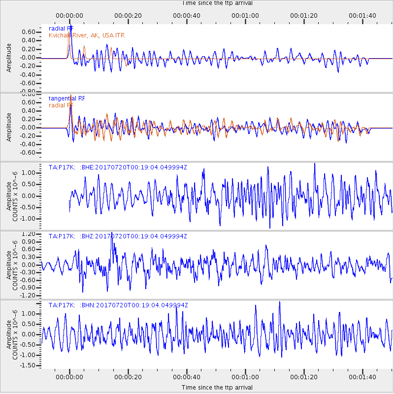
P17K Kvichak River, AK, USA - Earthquake Result Viewer
*The percent match for this event was below the threshold and hence no stack was calculated.
| Earthquake location: |
Near East Coast Of Honshu, Japan |
| Earthquake latitude/longitude: |
37.4/141.6 |
| Earthquake time(UTC): |
2017/07/20 (201) 00:11:25 GMT |
| Earthquake Depth: |
35 km |
| Earthquake Magnitude: |
5.8 Mww |
| Earthquake Catalog/Contributor: |
NEIC PDE/us |
|
| Network: |
TA USArray Transportable Network (new EarthScope stations) |
| Station: |
P17K Kvichak River, AK, USA |
| Lat/Lon: |
59.20 N/156.44 W |
| Elevation: |
91 m |
|
| Distance: |
44.7 deg |
| Az: |
40.27 deg |
| Baz: |
269.237 deg |
| Ray Param: |
$rayparam |
*The percent match for this event was below the threshold and hence was not used in the summary stack. |
|
| Radial Match: |
64.48654 % |
| Radial Bump: |
400 |
| Transverse Match: |
50.50566 % |
| Transverse Bump: |
400 |
| SOD ConfigId: |
13570011 |
| Insert Time: |
2019-04-28 10:34:17.575 +0000 |
| GWidth: |
2.5 |
| Max Bumps: |
400 |
| Tol: |
0.001 |
|
Signal To Noise
| Channel | StoN | STA | LTA |
| TA:P17K: :BHZ:20170720T00:19:04.049994Z | 2.6607997 | 3.6368627E-7 | 1.3668306E-7 |
| TA:P17K: :BHN:20170720T00:19:04.049994Z | 1.1150538 | 4.840572E-7 | 4.341111E-7 |
| TA:P17K: :BHE:20170720T00:19:04.049994Z | 0.82249004 | 2.9283729E-7 | 3.5603748E-7 |
| Arrivals |
| Ps | |
| PpPs | |
| PsPs/PpSs | |


