You are here: Home > Network List > US - United States National Seismic Network Stations List
> Station MNTX Cornudas Mountains, Texas, USA > Earthquake Result Viewer
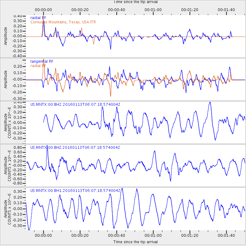
MNTX Cornudas Mountains, Texas, USA - Earthquake Result Viewer
*The percent match for this event was below the threshold and hence no stack was calculated.
| Earthquake location: |
Tonga Islands |
| Earthquake latitude/longitude: |
-15.2/-174.9 |
| Earthquake time(UTC): |
2016/01/13 (013) 05:55:59 GMT |
| Earthquake Depth: |
233 km |
| Earthquake Magnitude: |
5.8 MB |
| Earthquake Catalog/Contributor: |
NEIC PDE/NEIC COMCAT |
|
| Network: |
US United States National Seismic Network |
| Station: |
MNTX Cornudas Mountains, Texas, USA |
| Lat/Lon: |
31.70 N/105.38 W |
| Elevation: |
404 m |
|
| Distance: |
81.3 deg |
| Az: |
53.889 deg |
| Baz: |
246.213 deg |
| Ray Param: |
$rayparam |
*The percent match for this event was below the threshold and hence was not used in the summary stack. |
|
| Radial Match: |
72.50531 % |
| Radial Bump: |
352 |
| Transverse Match: |
65.32931 % |
| Transverse Bump: |
400 |
| SOD ConfigId: |
1399611 |
| Insert Time: |
2016-01-27 06:16:29.684 +0000 |
| GWidth: |
2.5 |
| Max Bumps: |
400 |
| Tol: |
0.001 |
|
Signal To Noise
| Channel | StoN | STA | LTA |
| US:MNTX:00:BHZ:20160113T06:07:18.574004Z | 2.2589016 | 3.1982273E-7 | 1.415833E-7 |
| US:MNTX:00:BH1:20160113T06:07:18.574004Z | 0.6205529 | 1.1986029E-7 | 1.931508E-7 |
| US:MNTX:00:BH2:20160113T06:07:18.574004Z | 1.4747255 | 1.3022367E-7 | 8.830367E-8 |
| Arrivals |
| Ps | |
| PpPs | |
| PsPs/PpSs | |


