You are here: Home > Network List > UW - Pacific Northwest Regional Seismic Network Stations List
> Station UMAT Pilot Rock, OR, USA > Earthquake Result Viewer
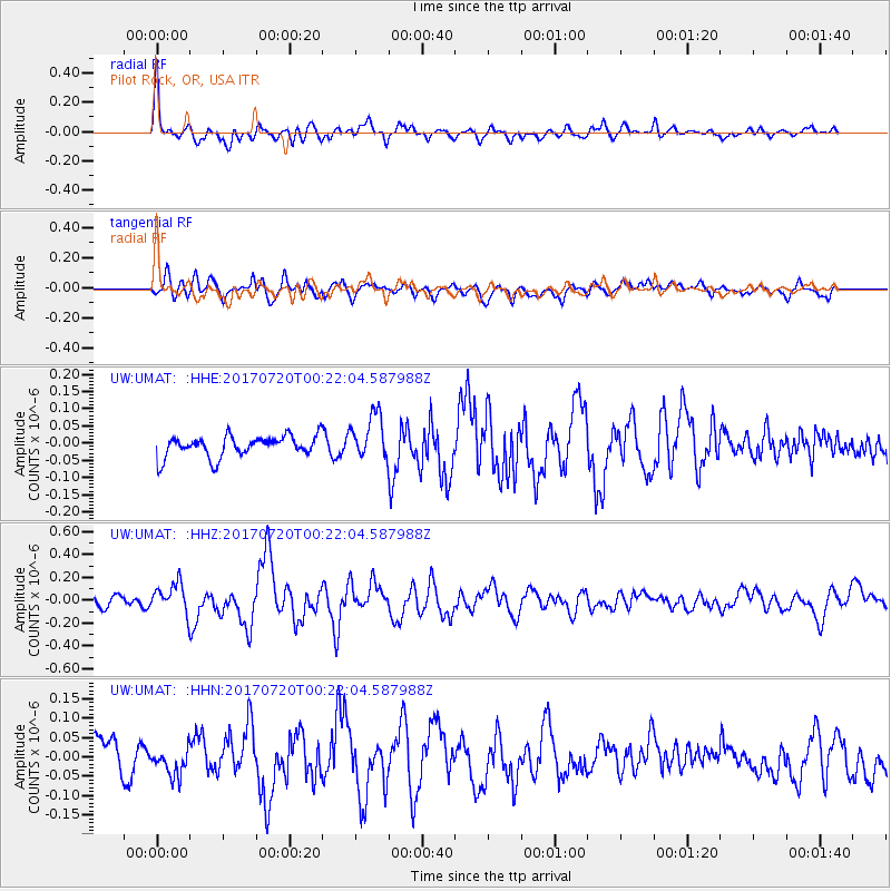
UMAT Pilot Rock, OR, USA - Earthquake Result Viewer
*The percent match for this event was below the threshold and hence no stack was calculated.
| Earthquake location: |
Near East Coast Of Honshu, Japan |
| Earthquake latitude/longitude: |
37.4/141.6 |
| Earthquake time(UTC): |
2017/07/20 (201) 00:11:25 GMT |
| Earthquake Depth: |
35 km |
| Earthquake Magnitude: |
5.8 Mww |
| Earthquake Catalog/Contributor: |
NEIC PDE/us |
|
| Network: |
UW Pacific Northwest Regional Seismic Network |
| Station: |
UMAT Pilot Rock, OR, USA |
| Lat/Lon: |
45.29 N/118.96 W |
| Elevation: |
1318 m |
|
| Distance: |
70.3 deg |
| Az: |
47.681 deg |
| Baz: |
303.497 deg |
| Ray Param: |
$rayparam |
*The percent match for this event was below the threshold and hence was not used in the summary stack. |
|
| Radial Match: |
77.01871 % |
| Radial Bump: |
400 |
| Transverse Match: |
64.98312 % |
| Transverse Bump: |
400 |
| SOD ConfigId: |
13570011 |
| Insert Time: |
2019-04-28 10:35:39.399 +0000 |
| GWidth: |
2.5 |
| Max Bumps: |
400 |
| Tol: |
0.001 |
|
Signal To Noise
| Channel | StoN | STA | LTA |
| UW:UMAT: :HHZ:20170720T00:22:04.587988Z | 2.6285527 | 1.2774304E-7 | 4.8598235E-8 |
| UW:UMAT: :HHN:20170720T00:22:04.587988Z | 0.561554 | 3.5312862E-8 | 6.288418E-8 |
| UW:UMAT: :HHE:20170720T00:22:04.587988Z | 2.1648734 | 6.631609E-8 | 3.063278E-8 |
| Arrivals |
| Ps | |
| PpPs | |
| PsPs/PpSs | |


