You are here: Home > Network List > TA - USArray Transportable Network (new EarthScope stations) Stations List
> Station P31A Stockton, KS, USA > Earthquake Result Viewer
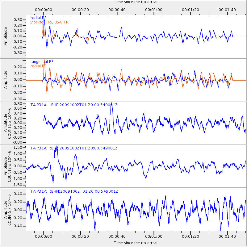
P31A Stockton, KS, USA - Earthquake Result Viewer
*The percent match for this event was below the threshold and hence no stack was calculated.
| Earthquake location: |
Tonga Islands |
| Earthquake latitude/longitude: |
-16.3/-173.5 |
| Earthquake time(UTC): |
2009/10/02 (275) 01:07:39 GMT |
| Earthquake Depth: |
8.0 km |
| Earthquake Magnitude: |
6.1 MB, 6.0 MS, 6.1 MW, 6.1 MW |
| Earthquake Catalog/Contributor: |
WHDF/NEIC |
|
| Network: |
TA USArray Transportable Network (new EarthScope stations) |
| Station: |
P31A Stockton, KS, USA |
| Lat/Lon: |
39.52 N/99.38 W |
| Elevation: |
665 m |
|
| Distance: |
88.5 deg |
| Az: |
48.084 deg |
| Baz: |
247.472 deg |
| Ray Param: |
$rayparam |
*The percent match for this event was below the threshold and hence was not used in the summary stack. |
|
| Radial Match: |
65.02338 % |
| Radial Bump: |
400 |
| Transverse Match: |
56.854294 % |
| Transverse Bump: |
400 |
| SOD ConfigId: |
2622 |
| Insert Time: |
2010-03-06 02:08:44.802 +0000 |
| GWidth: |
2.5 |
| Max Bumps: |
400 |
| Tol: |
0.001 |
|
Signal To Noise
| Channel | StoN | STA | LTA |
| TA:P31A: :BHZ:20091002T01:20:00.549001Z | 2.8421152 | 3.2017957E-7 | 1.12655385E-7 |
| TA:P31A: :BHN:20091002T01:20:00.549001Z | 1.0904002 | 1.6652612E-7 | 1.5272018E-7 |
| TA:P31A: :BHE:20091002T01:20:00.549001Z | 1.9785411 | 2.4507705E-7 | 1.2386757E-7 |
| Arrivals |
| Ps | |
| PpPs | |
| PsPs/PpSs | |


