You are here: Home > Network List > TA - USArray Transportable Network (new EarthScope stations) Stations List
> Station P31A Stockton, KS, USA > Earthquake Result Viewer
P31A Stockton, KS, USA - Earthquake Result Viewer
*The percent match for this event was below the threshold and hence no stack was calculated.
| Earthquake location: |
Eastern Mediterranean Sea |
| Earthquake latitude/longitude: |
35.4/28.5 |
| Earthquake time(UTC): |
2009/06/19 (170) 14:04:59 GMT |
| Earthquake Depth: |
28 km |
| Earthquake Magnitude: |
5.6 MB, 5.6 MS, 5.8 MW, 5.8 MW |
| Earthquake Catalog/Contributor: |
WHDF/NEIC |
|
| Network: |
TA USArray Transportable Network (new EarthScope stations) |
| Station: |
P31A Stockton, KS, USA |
| Lat/Lon: |
39.52 N/99.38 W |
| Elevation: |
665 m |
|
| Distance: |
91.3 deg |
| Az: |
322.333 deg |
| Baz: |
40.222 deg |
| Ray Param: |
$rayparam |
*The percent match for this event was below the threshold and hence was not used in the summary stack. |
|
| Radial Match: |
48.571644 % |
| Radial Bump: |
400 |
| Transverse Match: |
67.58839 % |
| Transverse Bump: |
400 |
| SOD ConfigId: |
2648 |
| Insert Time: |
2010-03-06 02:08:51.159 +0000 |
| GWidth: |
2.5 |
| Max Bumps: |
400 |
| Tol: |
0.001 |
|
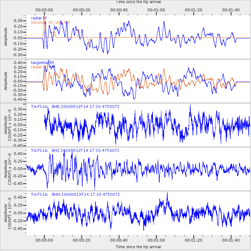
Signal To Noise
| Channel | StoN | STA | LTA |
| TA:P31A: :BHZ:20090619T14:17:30.475007Z | 3.6902869 | 2.3638643E-7 | 6.405638E-8 |
| TA:P31A: :BHN:20090619T14:17:30.475007Z | 0.9089635 | 9.963726E-8 | 1.0961635E-7 |
| TA:P31A: :BHE:20090619T14:17:30.475007Z | 1.3962816 | 1.6265072E-7 | 1.1648848E-7 |
| Arrivals |
| Ps | |
| PpPs | |
| PsPs/PpSs | |


