You are here: Home > Network List > II - Global Seismograph Network (GSN - IRIS/IDA) Stations List
> Station WRAB Tennant Creek, NT, Australia > Earthquake Result Viewer
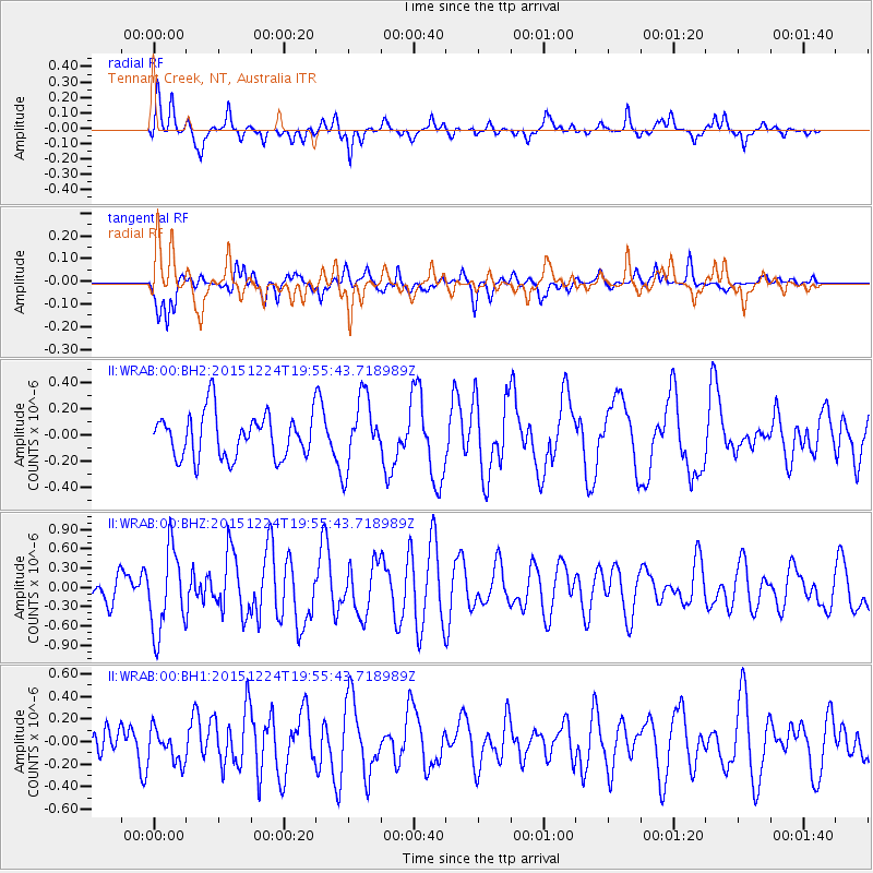
WRAB Tennant Creek, NT, Australia - Earthquake Result Viewer
*The percent match for this event was below the threshold and hence no stack was calculated.
| Earthquake location: |
Southern East Pacific Rise |
| Earthquake latitude/longitude: |
-55.8/-123.1 |
| Earthquake time(UTC): |
2015/12/24 (358) 19:44:03 GMT |
| Earthquake Depth: |
12 km |
| Earthquake Magnitude: |
6.2 MWW, 6.1 MWB, 6.2 MWC |
| Earthquake Catalog/Contributor: |
NEIC PDE/NEIC COMCAT |
|
| Network: |
II Global Seismograph Network (GSN - IRIS/IDA) |
| Station: |
WRAB Tennant Creek, NT, Australia |
| Lat/Lon: |
19.93 S/134.36 E |
| Elevation: |
366 m |
|
| Distance: |
80.5 deg |
| Az: |
248.603 deg |
| Baz: |
145.982 deg |
| Ray Param: |
$rayparam |
*The percent match for this event was below the threshold and hence was not used in the summary stack. |
|
| Radial Match: |
74.89501 % |
| Radial Bump: |
400 |
| Transverse Match: |
65.44744 % |
| Transverse Bump: |
400 |
| SOD ConfigId: |
1399611 |
| Insert Time: |
2016-01-28 00:28:13.052 +0000 |
| GWidth: |
2.5 |
| Max Bumps: |
400 |
| Tol: |
0.001 |
|
Signal To Noise
| Channel | StoN | STA | LTA |
| II:WRAB:00:BHZ:20151224T19:55:43.718989Z | 2.3490705 | 6.384736E-7 | 2.7179837E-7 |
| II:WRAB:00:BH1:20151224T19:55:43.718989Z | 1.2016375 | 1.4499494E-7 | 1.2066445E-7 |
| II:WRAB:00:BH2:20151224T19:55:43.718989Z | 1.5415375 | 2.6368113E-7 | 1.7105074E-7 |
| Arrivals |
| Ps | |
| PpPs | |
| PsPs/PpSs | |


