You are here: Home > Network List > TA - USArray Transportable Network (new EarthScope stations) Stations List
> Station 121A Cookes Peak, Deming, NM, USA > Earthquake Result Viewer
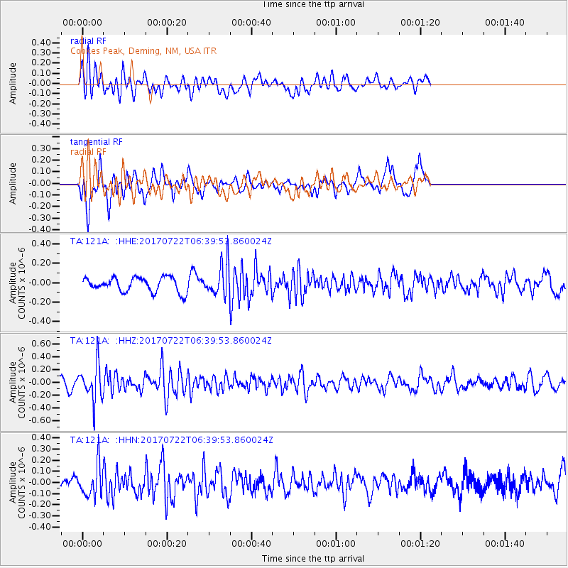
121A Cookes Peak, Deming, NM, USA - Earthquake Result Viewer
*The percent match for this event was below the threshold and hence no stack was calculated.
| Earthquake location: |
Northern Chile |
| Earthquake latitude/longitude: |
-21.2/-69.3 |
| Earthquake time(UTC): |
2017/07/22 (203) 06:29:50 GMT |
| Earthquake Depth: |
49 km |
| Earthquake Magnitude: |
5.3 Mww |
| Earthquake Catalog/Contributor: |
NEIC PDE/us |
|
| Network: |
TA USArray Transportable Network (new EarthScope stations) |
| Station: |
121A Cookes Peak, Deming, NM, USA |
| Lat/Lon: |
32.53 N/107.79 W |
| Elevation: |
1652 m |
|
| Distance: |
64.9 deg |
| Az: |
324.48 deg |
| Baz: |
140.075 deg |
| Ray Param: |
$rayparam |
*The percent match for this event was below the threshold and hence was not used in the summary stack. |
|
| Radial Match: |
51.836777 % |
| Radial Bump: |
400 |
| Transverse Match: |
55.774284 % |
| Transverse Bump: |
364 |
| SOD ConfigId: |
13570011 |
| Insert Time: |
2019-04-28 11:02:21.279 +0000 |
| GWidth: |
2.5 |
| Max Bumps: |
400 |
| Tol: |
0.001 |
|
Signal To Noise
| Channel | StoN | STA | LTA |
| TA:121A: :HHZ:20170722T06:39:53.860024Z | 5.108886 | 2.9803013E-7 | 5.8335644E-8 |
| TA:121A: :HHN:20170722T06:39:53.860024Z | 2.9718192 | 1.4447184E-7 | 4.861394E-8 |
| TA:121A: :HHE:20170722T06:39:53.860024Z | 2.4235237 | 1.7813825E-7 | 7.350382E-8 |
| Arrivals |
| Ps | |
| PpPs | |
| PsPs/PpSs | |


