You are here: Home > Network List > TA - USArray Transportable Network (new EarthScope stations) Stations List
> Station 435B Jarrell, TX, USA > Earthquake Result Viewer
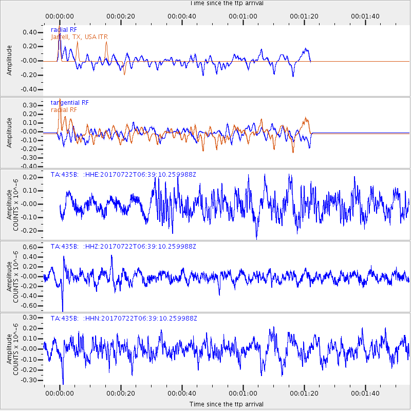
435B Jarrell, TX, USA - Earthquake Result Viewer
*The percent match for this event was below the threshold and hence no stack was calculated.
| Earthquake location: |
Northern Chile |
| Earthquake latitude/longitude: |
-21.2/-69.3 |
| Earthquake time(UTC): |
2017/07/22 (203) 06:29:50 GMT |
| Earthquake Depth: |
49 km |
| Earthquake Magnitude: |
5.3 Mww |
| Earthquake Catalog/Contributor: |
NEIC PDE/us |
|
| Network: |
TA USArray Transportable Network (new EarthScope stations) |
| Station: |
435B Jarrell, TX, USA |
| Lat/Lon: |
30.78 N/97.58 W |
| Elevation: |
248 m |
|
| Distance: |
58.4 deg |
| Az: |
331.357 deg |
| Baz: |
148.686 deg |
| Ray Param: |
$rayparam |
*The percent match for this event was below the threshold and hence was not used in the summary stack. |
|
| Radial Match: |
70.67572 % |
| Radial Bump: |
400 |
| Transverse Match: |
54.34459 % |
| Transverse Bump: |
400 |
| SOD ConfigId: |
13570011 |
| Insert Time: |
2019-04-28 11:02:23.576 +0000 |
| GWidth: |
2.5 |
| Max Bumps: |
400 |
| Tol: |
0.001 |
|
Signal To Noise
| Channel | StoN | STA | LTA |
| TA:435B: :HHZ:20170722T06:39:10.259988Z | 2.4276924 | 2.0772735E-7 | 8.5565766E-8 |
| TA:435B: :HHN:20170722T06:39:10.259988Z | 2.161897 | 9.620551E-8 | 4.4500506E-8 |
| TA:435B: :HHE:20170722T06:39:10.259988Z | 2.1182196 | 1.006187E-7 | 4.750154E-8 |
| Arrivals |
| Ps | |
| PpPs | |
| PsPs/PpSs | |


