You are here: Home > Network List > TA - USArray Transportable Network (new EarthScope stations) Stations List
> Station H17A Grant Village (NPS), Yellowstone Nt. Park, WY, USA > Earthquake Result Viewer
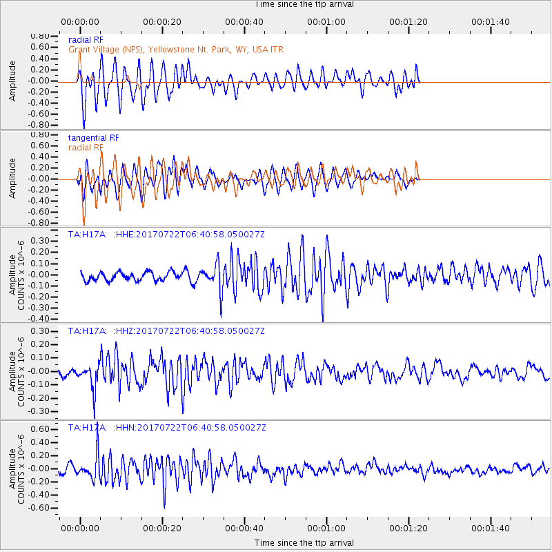
H17A Grant Village (NPS), Yellowstone Nt. Park, WY, USA - Earthquake Result Viewer
*The percent match for this event was below the threshold and hence no stack was calculated.
| Earthquake location: |
Northern Chile |
| Earthquake latitude/longitude: |
-21.2/-69.3 |
| Earthquake time(UTC): |
2017/07/22 (203) 06:29:50 GMT |
| Earthquake Depth: |
49 km |
| Earthquake Magnitude: |
5.3 Mww |
| Earthquake Catalog/Contributor: |
NEIC PDE/us |
|
| Network: |
TA USArray Transportable Network (new EarthScope stations) |
| Station: |
H17A Grant Village (NPS), Yellowstone Nt. Park, WY, USA |
| Lat/Lon: |
44.40 N/110.58 W |
| Elevation: |
2400 m |
|
| Distance: |
75.4 deg |
| Az: |
330.723 deg |
| Baz: |
140.466 deg |
| Ray Param: |
$rayparam |
*The percent match for this event was below the threshold and hence was not used in the summary stack. |
|
| Radial Match: |
47.238018 % |
| Radial Bump: |
400 |
| Transverse Match: |
52.7907 % |
| Transverse Bump: |
400 |
| SOD ConfigId: |
13570011 |
| Insert Time: |
2019-04-28 11:02:25.089 +0000 |
| GWidth: |
2.5 |
| Max Bumps: |
400 |
| Tol: |
0.001 |
|
Signal To Noise
| Channel | StoN | STA | LTA |
| TA:H17A: :HHZ:20170722T06:40:58.050027Z | 2.456421 | 9.5587545E-8 | 3.8913342E-8 |
| TA:H17A: :HHN:20170722T06:40:58.050027Z | 5.1508255 | 1.9339413E-7 | 3.754624E-8 |
| TA:H17A: :HHE:20170722T06:40:58.050027Z | 3.2095032 | 1.1666039E-7 | 3.634843E-8 |
| Arrivals |
| Ps | |
| PpPs | |
| PsPs/PpSs | |


