You are here: Home > Network List > TA - USArray Transportable Network (new EarthScope stations) Stations List
> Station K13K Kusilvak Mountain, AK, USA > Earthquake Result Viewer
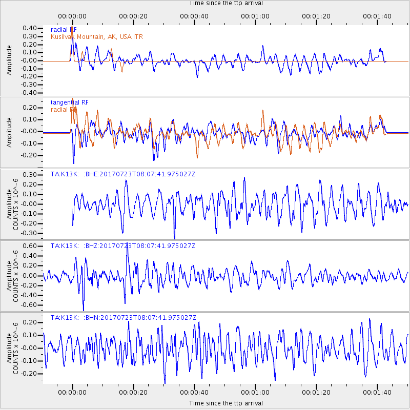
K13K Kusilvak Mountain, AK, USA - Earthquake Result Viewer
*The percent match for this event was below the threshold and hence no stack was calculated.
| Earthquake location: |
Minahassa Peninsula, Sulawesi |
| Earthquake latitude/longitude: |
0.3/120.2 |
| Earthquake time(UTC): |
2017/07/23 (204) 07:55:55 GMT |
| Earthquake Depth: |
56 km |
| Earthquake Magnitude: |
5.5 Mww |
| Earthquake Catalog/Contributor: |
NEIC PDE/us |
|
| Network: |
TA USArray Transportable Network (new EarthScope stations) |
| Station: |
K13K Kusilvak Mountain, AK, USA |
| Lat/Lon: |
61.93 N/164.66 W |
| Elevation: |
204 m |
|
| Distance: |
82.8 deg |
| Az: |
27.44 deg |
| Baz: |
256.981 deg |
| Ray Param: |
$rayparam |
*The percent match for this event was below the threshold and hence was not used in the summary stack. |
|
| Radial Match: |
49.444466 % |
| Radial Bump: |
400 |
| Transverse Match: |
62.313255 % |
| Transverse Bump: |
400 |
| SOD ConfigId: |
13570011 |
| Insert Time: |
2019-04-28 11:06:57.604 +0000 |
| GWidth: |
2.5 |
| Max Bumps: |
400 |
| Tol: |
0.001 |
|
Signal To Noise
| Channel | StoN | STA | LTA |
| TA:K13K: :BHZ:20170723T08:07:41.975027Z | 2.9634893 | 2.5928233E-7 | 8.7492246E-8 |
| TA:K13K: :BHN:20170723T08:07:41.975027Z | 0.9872431 | 6.838721E-8 | 6.927089E-8 |
| TA:K13K: :BHE:20170723T08:07:41.975027Z | 1.3153112 | 1.2498077E-7 | 9.501993E-8 |
| Arrivals |
| Ps | |
| PpPs | |
| PsPs/PpSs | |


