You are here: Home > Network List > NE - New England Seismic Network Stations List
> Station PQI Presque Isle, ME, USA > Earthquake Result Viewer
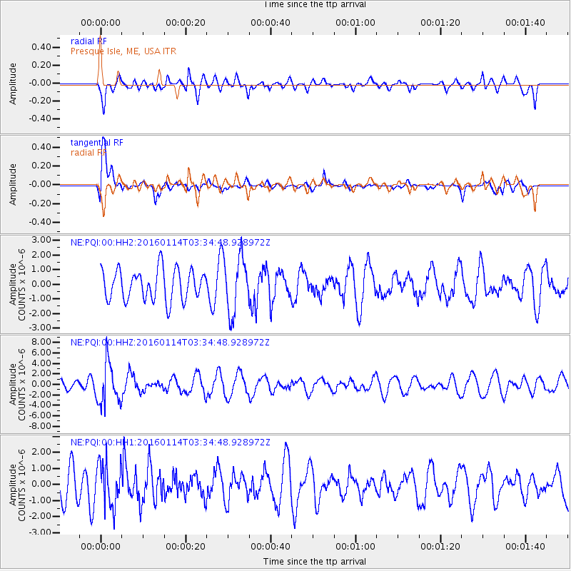
PQI Presque Isle, ME, USA - Earthquake Result Viewer
*The percent match for this event was below the threshold and hence no stack was calculated.
| Earthquake location: |
Southern Bolivia |
| Earthquake latitude/longitude: |
-19.8/-63.3 |
| Earthquake time(UTC): |
2016/01/14 (014) 03:25:28 GMT |
| Earthquake Depth: |
582 km |
| Earthquake Magnitude: |
6.1 MWW, 6.1 MWB |
| Earthquake Catalog/Contributor: |
NEIC PDE/NEIC COMCAT |
|
| Network: |
NE New England Seismic Network |
| Station: |
PQI Presque Isle, ME, USA |
| Lat/Lon: |
46.67 N/68.02 W |
| Elevation: |
162 m |
|
| Distance: |
66.3 deg |
| Az: |
356.442 deg |
| Baz: |
175.133 deg |
| Ray Param: |
$rayparam |
*The percent match for this event was below the threshold and hence was not used in the summary stack. |
|
| Radial Match: |
65.49489 % |
| Radial Bump: |
400 |
| Transverse Match: |
78.594505 % |
| Transverse Bump: |
400 |
| SOD ConfigId: |
1399611 |
| Insert Time: |
2016-01-28 04:07:35.693 +0000 |
| GWidth: |
2.5 |
| Max Bumps: |
400 |
| Tol: |
0.001 |
|
Signal To Noise
| Channel | StoN | STA | LTA |
| NE:PQI:00:HHZ:20160114T03:34:48.928972Z | 2.7003868 | 3.8813546E-6 | 1.4373329E-6 |
| NE:PQI:00:HH1:20160114T03:34:48.928972Z | 1.6051364 | 1.3532956E-6 | 8.431032E-7 |
| NE:PQI:00:HH2:20160114T03:34:48.928972Z | 1.7913733 | 1.8713026E-6 | 1.0446191E-6 |
| Arrivals |
| Ps | |
| PpPs | |
| PsPs/PpSs | |


