You are here: Home > Network List > TA - USArray Transportable Network (new EarthScope stations) Stations List
> Station D23K Nanushuk River, AK USA > Earthquake Result Viewer
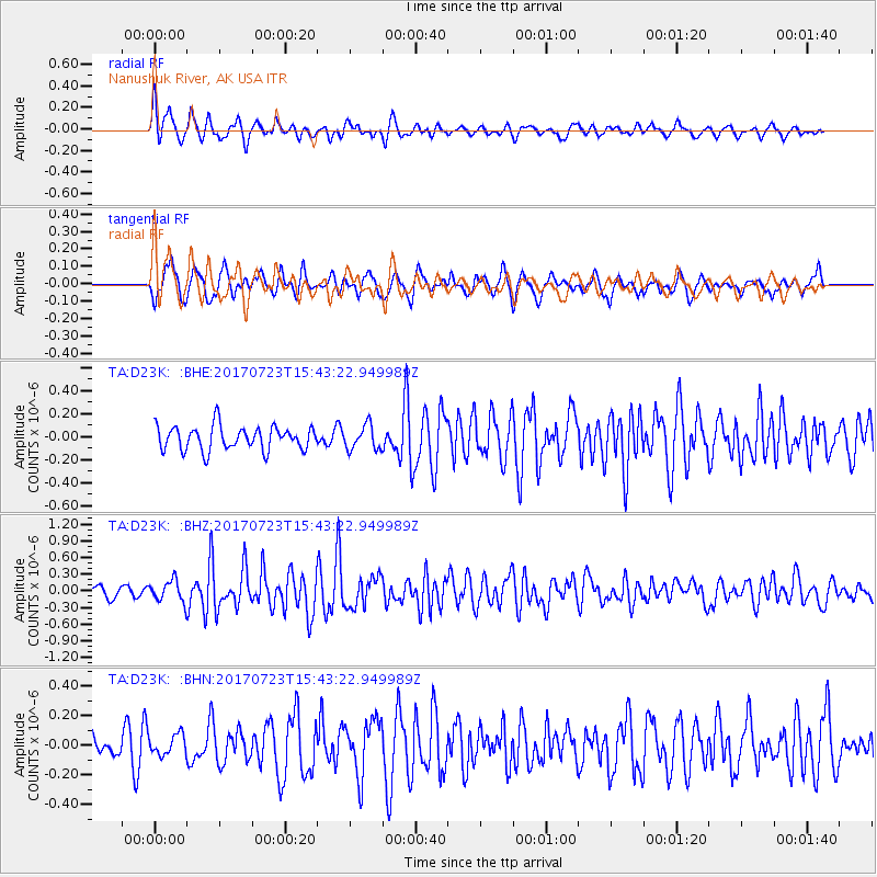
D23K Nanushuk River, AK USA - Earthquake Result Viewer
*The percent match for this event was below the threshold and hence no stack was calculated.
| Earthquake location: |
Off East Coast Of Honshu, Japan |
| Earthquake latitude/longitude: |
40.0/143.5 |
| Earthquake time(UTC): |
2017/07/23 (204) 15:35:40 GMT |
| Earthquake Depth: |
10 km |
| Earthquake Magnitude: |
5.6 Mww |
| Earthquake Catalog/Contributor: |
NEIC PDE/us |
|
| Network: |
TA USArray Transportable Network (new EarthScope stations) |
| Station: |
D23K Nanushuk River, AK USA |
| Lat/Lon: |
68.97 N/150.68 W |
| Elevation: |
406 m |
|
| Distance: |
44.7 deg |
| Az: |
27.937 deg |
| Baz: |
264.969 deg |
| Ray Param: |
$rayparam |
*The percent match for this event was below the threshold and hence was not used in the summary stack. |
|
| Radial Match: |
79.13741 % |
| Radial Bump: |
393 |
| Transverse Match: |
69.82334 % |
| Transverse Bump: |
400 |
| SOD ConfigId: |
13570011 |
| Insert Time: |
2019-04-28 11:14:39.306 +0000 |
| GWidth: |
2.5 |
| Max Bumps: |
400 |
| Tol: |
0.001 |
|
Signal To Noise
| Channel | StoN | STA | LTA |
| TA:D23K: :BHZ:20170723T15:43:22.949989Z | 1.588582 | 1.8998374E-7 | 1.1959328E-7 |
| TA:D23K: :BHN:20170723T15:43:22.949989Z | 0.62411475 | 6.8217695E-8 | 1.0930313E-7 |
| TA:D23K: :BHE:20170723T15:43:22.949989Z | 1.0205777 | 1.0576059E-7 | 1.0362817E-7 |
| Arrivals |
| Ps | |
| PpPs | |
| PsPs/PpSs | |


