You are here: Home > Network List > TA - USArray Transportable Network (new EarthScope stations) Stations List
> Station WHTX Lake Whitney, Meridian, TX, USA > Earthquake Result Viewer
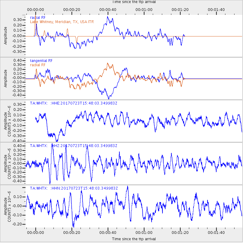
WHTX Lake Whitney, Meridian, TX, USA - Earthquake Result Viewer
*The percent match for this event was below the threshold and hence no stack was calculated.
| Earthquake location: |
Off East Coast Of Honshu, Japan |
| Earthquake latitude/longitude: |
40.0/143.5 |
| Earthquake time(UTC): |
2017/07/23 (204) 15:35:40 GMT |
| Earthquake Depth: |
10 km |
| Earthquake Magnitude: |
5.6 Mww |
| Earthquake Catalog/Contributor: |
NEIC PDE/us |
|
| Network: |
TA USArray Transportable Network (new EarthScope stations) |
| Station: |
WHTX Lake Whitney, Meridian, TX, USA |
| Lat/Lon: |
31.99 N/97.46 W |
| Elevation: |
190 m |
|
| Distance: |
88.8 deg |
| Az: |
47.98 deg |
| Baz: |
317.845 deg |
| Ray Param: |
$rayparam |
*The percent match for this event was below the threshold and hence was not used in the summary stack. |
|
| Radial Match: |
41.54785 % |
| Radial Bump: |
400 |
| Transverse Match: |
35.90796 % |
| Transverse Bump: |
400 |
| SOD ConfigId: |
13570011 |
| Insert Time: |
2019-04-28 11:15:14.886 +0000 |
| GWidth: |
2.5 |
| Max Bumps: |
400 |
| Tol: |
0.001 |
|
Signal To Noise
| Channel | StoN | STA | LTA |
| TA:WHTX: :HHZ:20170723T15:48:03.349983Z | 0.93539244 | 5.6975782E-8 | 6.09111E-8 |
| TA:WHTX: :HHN:20170723T15:48:03.349983Z | 0.48117843 | 3.1768707E-8 | 6.6022714E-8 |
| TA:WHTX: :HHE:20170723T15:48:03.349983Z | 1.2383465 | 1.958445E-7 | 1.5815E-7 |
| Arrivals |
| Ps | |
| PpPs | |
| PsPs/PpSs | |


