You are here: Home > Network List > AV - Alaska Volcano Observatory Stations List
> Station MAPS Pakushin Southeast, Makushin Volcano, Alaska > Earthquake Result Viewer
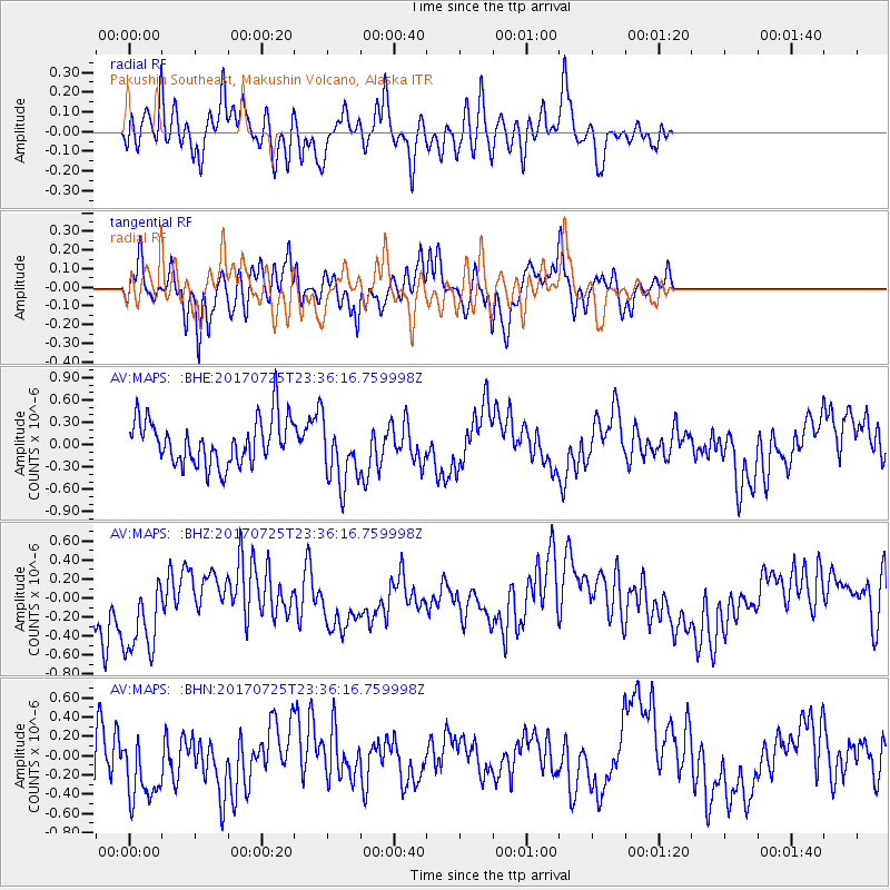
MAPS Pakushin Southeast, Makushin Volcano, Alaska - Earthquake Result Viewer
*The percent match for this event was below the threshold and hence no stack was calculated.
| Earthquake location: |
Southwest Of Sumatra, Indonesia |
| Earthquake latitude/longitude: |
-5.7/101.4 |
| Earthquake time(UTC): |
2017/07/25 (206) 23:23:23 GMT |
| Earthquake Depth: |
10 km |
| Earthquake Magnitude: |
5.5 mb |
| Earthquake Catalog/Contributor: |
NEIC PDE/us |
|
| Network: |
AV Alaska Volcano Observatory |
| Station: |
MAPS Pakushin Southeast, Makushin Volcano, Alaska |
| Lat/Lon: |
53.81 N/166.94 W |
| Elevation: |
333 m |
|
| Distance: |
95.5 deg |
| Az: |
36.554 deg |
| Baz: |
267.978 deg |
| Ray Param: |
$rayparam |
*The percent match for this event was below the threshold and hence was not used in the summary stack. |
|
| Radial Match: |
56.452667 % |
| Radial Bump: |
349 |
| Transverse Match: |
63.872723 % |
| Transverse Bump: |
400 |
| SOD ConfigId: |
13570011 |
| Insert Time: |
2019-04-28 11:17:20.340 +0000 |
| GWidth: |
2.5 |
| Max Bumps: |
400 |
| Tol: |
0.001 |
|
Signal To Noise
| Channel | StoN | STA | LTA |
| AV:MAPS: :BHZ:20170725T23:36:16.759998Z | 2.3236895 | 5.417981E-7 | 2.3316285E-7 |
| AV:MAPS: :BHN:20170725T23:36:16.759998Z | 1.2812657 | 3.9266274E-7 | 3.064647E-7 |
| AV:MAPS: :BHE:20170725T23:36:16.759998Z | 1.4304662 | 4.367458E-7 | 3.0531712E-7 |
| Arrivals |
| Ps | |
| PpPs | |
| PsPs/PpSs | |


