You are here: Home > Network List > US - United States National Seismic Network Stations List
> Station CBKS Cedar Bluff, Kansas, USA > Earthquake Result Viewer
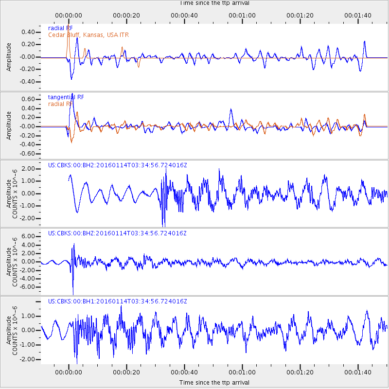
CBKS Cedar Bluff, Kansas, USA - Earthquake Result Viewer
*The percent match for this event was below the threshold and hence no stack was calculated.
| Earthquake location: |
Southern Bolivia |
| Earthquake latitude/longitude: |
-19.8/-63.3 |
| Earthquake time(UTC): |
2016/01/14 (014) 03:25:28 GMT |
| Earthquake Depth: |
582 km |
| Earthquake Magnitude: |
6.1 MWW, 6.1 MWB |
| Earthquake Catalog/Contributor: |
NEIC PDE/NEIC COMCAT |
|
| Network: |
US United States National Seismic Network |
| Station: |
CBKS Cedar Bluff, Kansas, USA |
| Lat/Lon: |
38.81 N/99.74 W |
| Elevation: |
677 m |
|
| Distance: |
67.6 deg |
| Az: |
329.863 deg |
| Baz: |
142.769 deg |
| Ray Param: |
$rayparam |
*The percent match for this event was below the threshold and hence was not used in the summary stack. |
|
| Radial Match: |
59.868835 % |
| Radial Bump: |
400 |
| Transverse Match: |
77.6867 % |
| Transverse Bump: |
400 |
| SOD ConfigId: |
1399611 |
| Insert Time: |
2016-01-28 04:11:04.495 +0000 |
| GWidth: |
2.5 |
| Max Bumps: |
400 |
| Tol: |
0.001 |
|
Signal To Noise
| Channel | StoN | STA | LTA |
| US:CBKS:00:BHZ:20160114T03:34:56.724016Z | 3.6491482 | 1.8747961E-6 | 5.1376264E-7 |
| US:CBKS:00:BH1:20160114T03:34:56.724016Z | 1.8781524 | 7.2220183E-7 | 3.845278E-7 |
| US:CBKS:00:BH2:20160114T03:34:56.724016Z | 1.5541475 | 9.455613E-7 | 6.084116E-7 |
| Arrivals |
| Ps | |
| PpPs | |
| PsPs/PpSs | |


