You are here: Home > Network List > AK - Alaska Regional Network Stations List
> Station GAMB Gambell Broadband > Earthquake Result Viewer
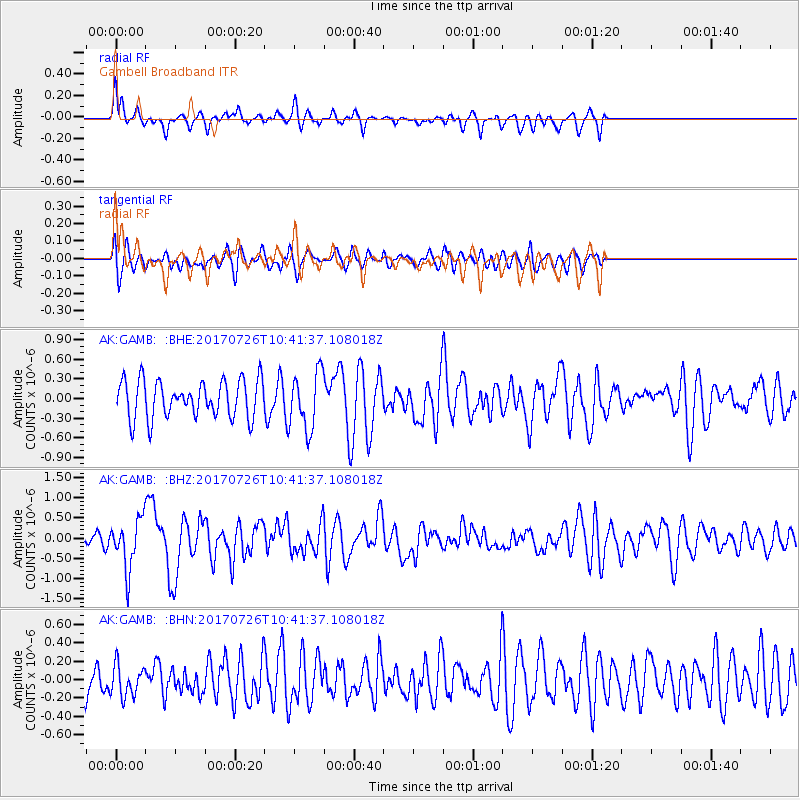
GAMB Gambell Broadband - Earthquake Result Viewer
*The percent match for this event was below the threshold and hence no stack was calculated.
| Earthquake location: |
Southeast Of Ryukyu Islands |
| Earthquake latitude/longitude: |
26.9/130.2 |
| Earthquake time(UTC): |
2017/07/26 (207) 10:32:57 GMT |
| Earthquake Depth: |
10 km |
| Earthquake Magnitude: |
5.9 Mww |
| Earthquake Catalog/Contributor: |
NEIC PDE/us |
|
| Network: |
AK Alaska Regional Network |
| Station: |
GAMB Gambell Broadband |
| Lat/Lon: |
63.78 N/171.70 W |
| Elevation: |
10 m |
|
| Distance: |
52.2 deg |
| Az: |
28.518 deg |
| Baz: |
253.641 deg |
| Ray Param: |
$rayparam |
*The percent match for this event was below the threshold and hence was not used in the summary stack. |
|
| Radial Match: |
50.802563 % |
| Radial Bump: |
400 |
| Transverse Match: |
62.882477 % |
| Transverse Bump: |
400 |
| SOD ConfigId: |
13570011 |
| Insert Time: |
2019-04-28 11:19:59.022 +0000 |
| GWidth: |
2.5 |
| Max Bumps: |
400 |
| Tol: |
0.001 |
|
Signal To Noise
| Channel | StoN | STA | LTA |
| AK:GAMB: :BHZ:20170726T10:41:37.108018Z | 2.7016973 | 6.3008815E-7 | 2.3321938E-7 |
| AK:GAMB: :BHN:20170726T10:41:37.108018Z | 0.7592175 | 1.6786979E-7 | 2.2110895E-7 |
| AK:GAMB: :BHE:20170726T10:41:37.108018Z | 1.5154965 | 4.314074E-7 | 2.8466408E-7 |
| Arrivals |
| Ps | |
| PpPs | |
| PsPs/PpSs | |


