You are here: Home > Network List > AZ - ANZA Regional Network Stations List
> Station SMER AZ.SMER > Earthquake Result Viewer
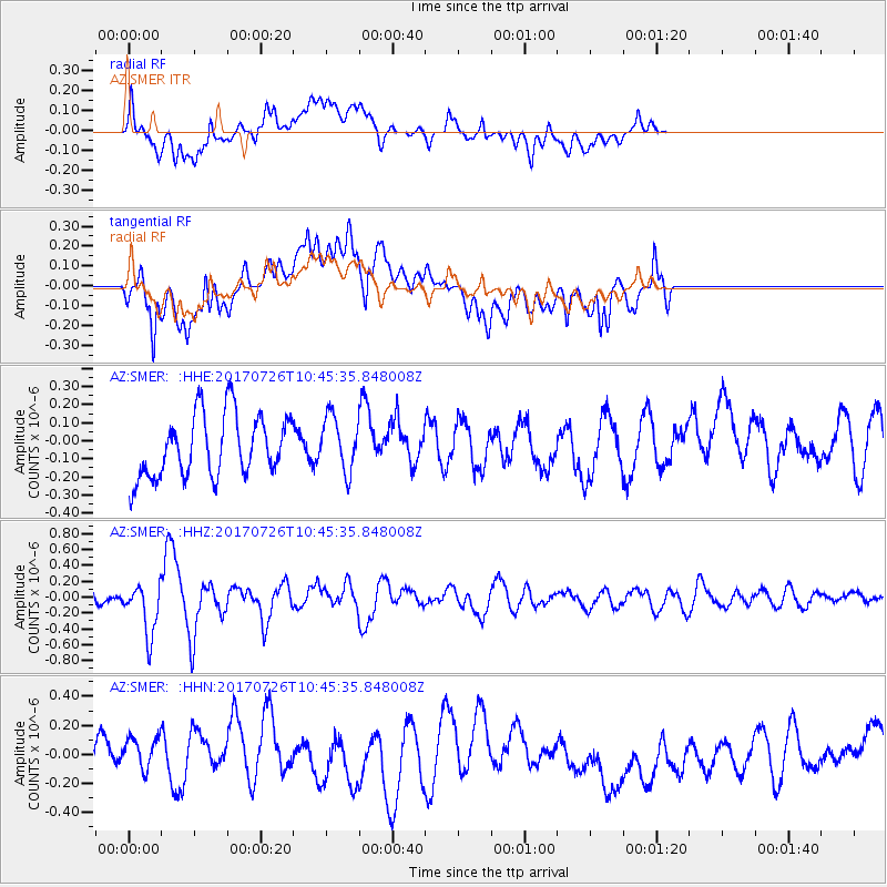
SMER AZ.SMER - Earthquake Result Viewer
*The percent match for this event was below the threshold and hence no stack was calculated.
| Earthquake location: |
Southeast Of Ryukyu Islands |
| Earthquake latitude/longitude: |
26.9/130.2 |
| Earthquake time(UTC): |
2017/07/26 (207) 10:32:57 GMT |
| Earthquake Depth: |
10 km |
| Earthquake Magnitude: |
5.9 Mww |
| Earthquake Catalog/Contributor: |
NEIC PDE/us |
|
| Network: |
AZ ANZA Regional Network |
| Station: |
SMER AZ.SMER |
| Lat/Lon: |
33.46 N/117.17 W |
| Elevation: |
355 m |
|
| Distance: |
92.3 deg |
| Az: |
50.552 deg |
| Baz: |
304.439 deg |
| Ray Param: |
$rayparam |
*The percent match for this event was below the threshold and hence was not used in the summary stack. |
|
| Radial Match: |
47.610622 % |
| Radial Bump: |
400 |
| Transverse Match: |
46.81257 % |
| Transverse Bump: |
400 |
| SOD ConfigId: |
13570011 |
| Insert Time: |
2019-04-28 11:21:30.985 +0000 |
| GWidth: |
2.5 |
| Max Bumps: |
400 |
| Tol: |
0.001 |
|
Signal To Noise
| Channel | StoN | STA | LTA |
| AZ:SMER: :HHZ:20170726T10:45:35.848008Z | 2.5102046 | 3.2979347E-7 | 1.3138111E-7 |
| AZ:SMER: :HHN:20170726T10:45:35.848008Z | 0.83861387 | 1.9311378E-7 | 2.3027735E-7 |
| AZ:SMER: :HHE:20170726T10:45:35.848008Z | 0.93589395 | 1.5946024E-7 | 1.7038282E-7 |
| Arrivals |
| Ps | |
| PpPs | |
| PsPs/PpSs | |


