You are here: Home > Network List > CI - Caltech Regional Seismic Network Stations List
> Station BFS Mt Baldy Forest Station > Earthquake Result Viewer
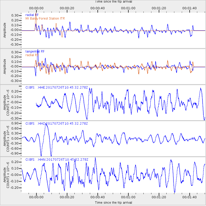
BFS Mt Baldy Forest Station - Earthquake Result Viewer
*The percent match for this event was below the threshold and hence no stack was calculated.
| Earthquake location: |
Southeast Of Ryukyu Islands |
| Earthquake latitude/longitude: |
26.9/130.2 |
| Earthquake time(UTC): |
2017/07/26 (207) 10:32:57 GMT |
| Earthquake Depth: |
10 km |
| Earthquake Magnitude: |
5.9 Mww |
| Earthquake Catalog/Contributor: |
NEIC PDE/us |
|
| Network: |
CI Caltech Regional Seismic Network |
| Station: |
BFS Mt Baldy Forest Station |
| Lat/Lon: |
34.24 N/117.66 W |
| Elevation: |
1312 m |
|
| Distance: |
91.5 deg |
| Az: |
50.137 deg |
| Baz: |
304.183 deg |
| Ray Param: |
$rayparam |
*The percent match for this event was below the threshold and hence was not used in the summary stack. |
|
| Radial Match: |
60.868362 % |
| Radial Bump: |
400 |
| Transverse Match: |
70.74826 % |
| Transverse Bump: |
400 |
| SOD ConfigId: |
13570011 |
| Insert Time: |
2019-04-28 11:22:01.918 +0000 |
| GWidth: |
2.5 |
| Max Bumps: |
400 |
| Tol: |
0.001 |
|
Signal To Noise
| Channel | StoN | STA | LTA |
| CI:BFS: :HHZ:20170726T10:45:32.278Z | 3.1802807 | 4.2636563E-7 | 1.340654E-7 |
| CI:BFS: :HHN:20170726T10:45:32.278Z | 1.2058312 | 1.0511494E-7 | 8.717219E-8 |
| CI:BFS: :HHE:20170726T10:45:32.278Z | 2.2765367 | 1.8435884E-7 | 8.0982154E-8 |
| Arrivals |
| Ps | |
| PpPs | |
| PsPs/PpSs | |


