You are here: Home > Network List > CI - Caltech Regional Seismic Network Stations List
> Station SWS Sam W. Stewart, Westmorland, CA, USA > Earthquake Result Viewer
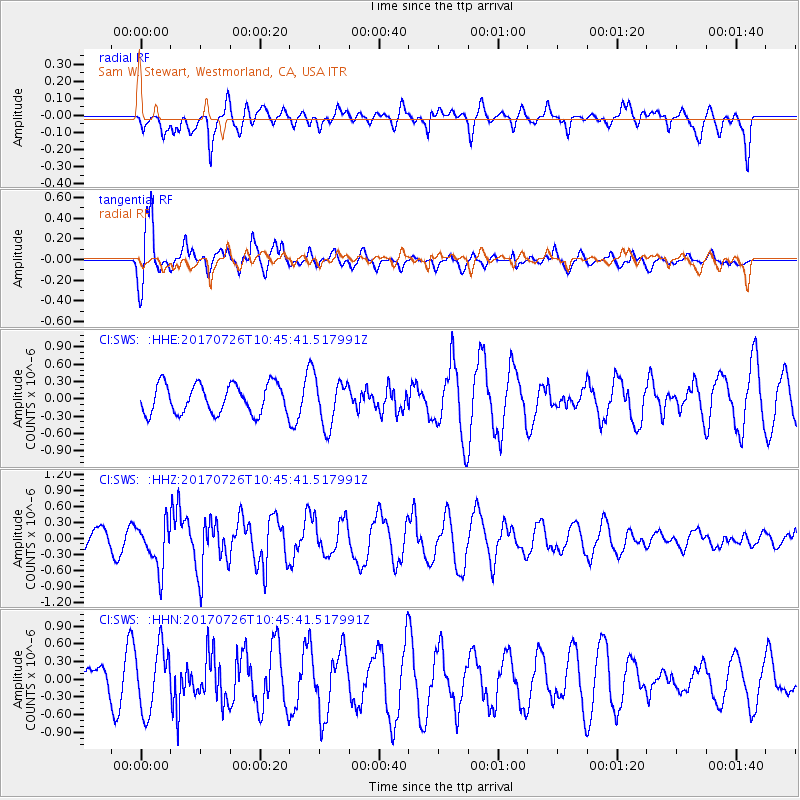
SWS Sam W. Stewart, Westmorland, CA, USA - Earthquake Result Viewer
*The percent match for this event was below the threshold and hence no stack was calculated.
| Earthquake location: |
Southeast Of Ryukyu Islands |
| Earthquake latitude/longitude: |
26.9/130.2 |
| Earthquake time(UTC): |
2017/07/26 (207) 10:32:57 GMT |
| Earthquake Depth: |
10 km |
| Earthquake Magnitude: |
5.9 Mww |
| Earthquake Catalog/Contributor: |
NEIC PDE/us |
|
| Network: |
CI Caltech Regional Seismic Network |
| Station: |
SWS Sam W. Stewart, Westmorland, CA, USA |
| Lat/Lon: |
32.94 N/115.80 W |
| Elevation: |
140 m |
|
| Distance: |
93.5 deg |
| Az: |
50.316 deg |
| Baz: |
305.201 deg |
| Ray Param: |
$rayparam |
*The percent match for this event was below the threshold and hence was not used in the summary stack. |
|
| Radial Match: |
39.61687 % |
| Radial Bump: |
400 |
| Transverse Match: |
74.98648 % |
| Transverse Bump: |
324 |
| SOD ConfigId: |
13570011 |
| Insert Time: |
2019-04-28 11:22:26.017 +0000 |
| GWidth: |
2.5 |
| Max Bumps: |
400 |
| Tol: |
0.001 |
|
Signal To Noise
| Channel | StoN | STA | LTA |
| CI:SWS: :HHZ:20170726T10:45:41.517991Z | 2.3422544 | 4.2727072E-7 | 1.8241857E-7 |
| CI:SWS: :HHN:20170726T10:45:41.517991Z | 2.025392 | 5.431132E-7 | 2.6815212E-7 |
| CI:SWS: :HHE:20170726T10:45:41.517991Z | 1.5172483 | 3.8803574E-7 | 2.5574968E-7 |
| Arrivals |
| Ps | |
| PpPs | |
| PsPs/PpSs | |


