You are here: Home > Network List > CN - Canadian National Seismograph Network Stations List
> Station LLLB Lillooet, BC, CA > Earthquake Result Viewer
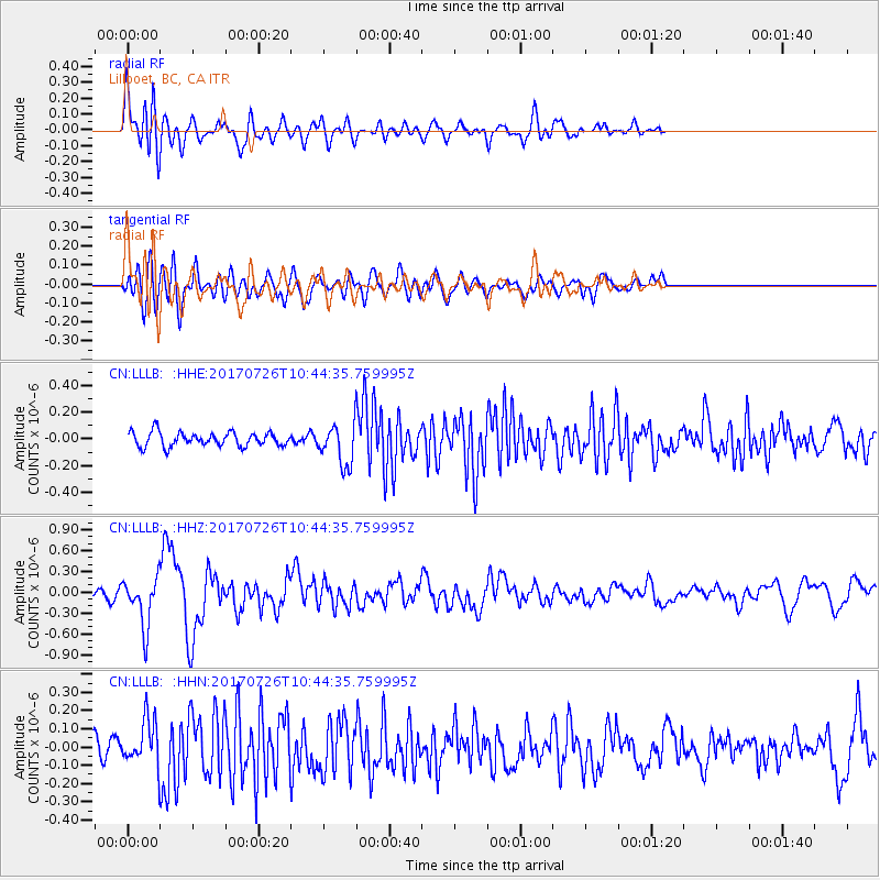
LLLB Lillooet, BC, CA - Earthquake Result Viewer
*The percent match for this event was below the threshold and hence no stack was calculated.
| Earthquake location: |
Southeast Of Ryukyu Islands |
| Earthquake latitude/longitude: |
26.9/130.2 |
| Earthquake time(UTC): |
2017/07/26 (207) 10:32:57 GMT |
| Earthquake Depth: |
10 km |
| Earthquake Magnitude: |
5.9 Mww |
| Earthquake Catalog/Contributor: |
NEIC PDE/us |
|
| Network: |
CN Canadian National Seismograph Network |
| Station: |
LLLB Lillooet, BC, CA |
| Lat/Lon: |
50.61 N/121.88 W |
| Elevation: |
700 m |
|
| Distance: |
80.1 deg |
| Az: |
37.98 deg |
| Baz: |
300.419 deg |
| Ray Param: |
$rayparam |
*The percent match for this event was below the threshold and hence was not used in the summary stack. |
|
| Radial Match: |
75.13009 % |
| Radial Bump: |
400 |
| Transverse Match: |
63.360992 % |
| Transverse Bump: |
400 |
| SOD ConfigId: |
13570011 |
| Insert Time: |
2019-04-28 11:22:50.276 +0000 |
| GWidth: |
2.5 |
| Max Bumps: |
400 |
| Tol: |
0.001 |
|
Signal To Noise
| Channel | StoN | STA | LTA |
| CN:LLLB: :HHZ:20170726T10:44:35.759995Z | 5.781433 | 3.5701808E-7 | 6.175252E-8 |
| CN:LLLB: :HHN:20170726T10:44:35.759995Z | 2.1300027 | 1.3230161E-7 | 6.211335E-8 |
| CN:LLLB: :HHE:20170726T10:44:35.759995Z | 3.2167144 | 1.6984444E-7 | 5.2800594E-8 |
| Arrivals |
| Ps | |
| PpPs | |
| PsPs/PpSs | |


