You are here: Home > Network List > TA - USArray Transportable Network (new EarthScope stations) Stations List
> Station K13K Kusilvak Mountain, AK, USA > Earthquake Result Viewer
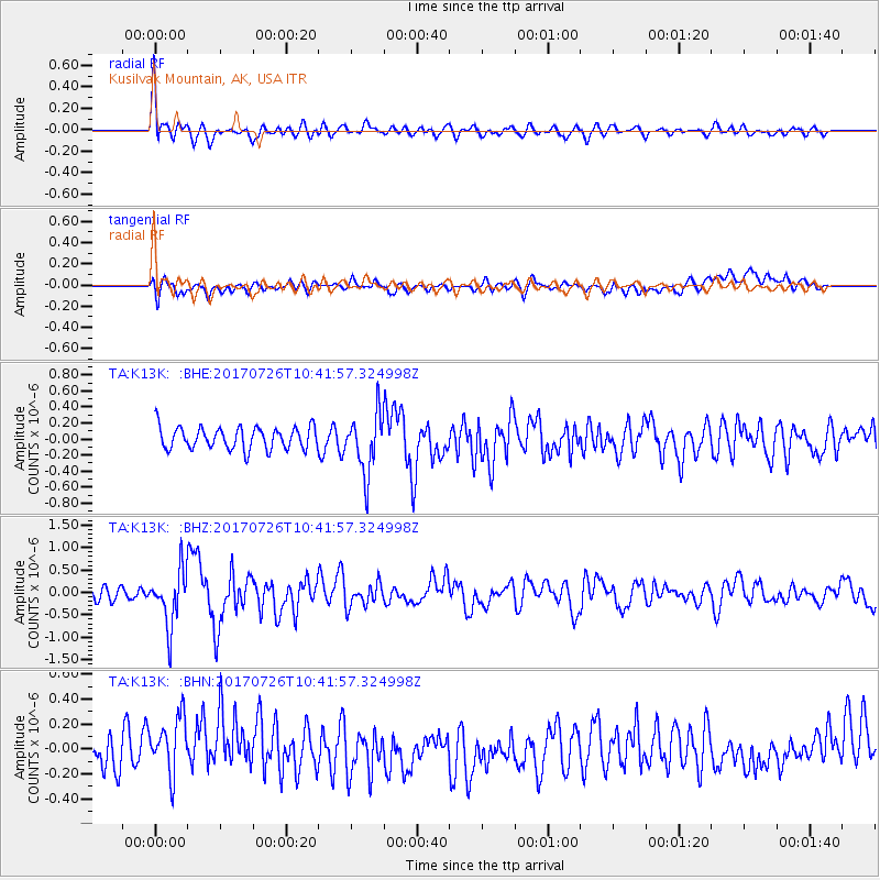
K13K Kusilvak Mountain, AK, USA - Earthquake Result Viewer
*The percent match for this event was below the threshold and hence no stack was calculated.
| Earthquake location: |
Southeast Of Ryukyu Islands |
| Earthquake latitude/longitude: |
26.9/130.2 |
| Earthquake time(UTC): |
2017/07/26 (207) 10:32:57 GMT |
| Earthquake Depth: |
10 km |
| Earthquake Magnitude: |
5.9 Mww |
| Earthquake Catalog/Contributor: |
NEIC PDE/us |
|
| Network: |
TA USArray Transportable Network (new EarthScope stations) |
| Station: |
K13K Kusilvak Mountain, AK, USA |
| Lat/Lon: |
61.93 N/164.66 W |
| Elevation: |
204 m |
|
| Distance: |
55.0 deg |
| Az: |
31.617 deg |
| Baz: |
261.745 deg |
| Ray Param: |
$rayparam |
*The percent match for this event was below the threshold and hence was not used in the summary stack. |
|
| Radial Match: |
76.59665 % |
| Radial Bump: |
400 |
| Transverse Match: |
50.550686 % |
| Transverse Bump: |
400 |
| SOD ConfigId: |
13570011 |
| Insert Time: |
2019-04-28 11:27:54.057 +0000 |
| GWidth: |
2.5 |
| Max Bumps: |
400 |
| Tol: |
0.001 |
|
Signal To Noise
| Channel | StoN | STA | LTA |
| TA:K13K: :BHZ:20170726T10:41:57.324998Z | 3.2740893 | 6.1937527E-7 | 1.8917481E-7 |
| TA:K13K: :BHN:20170726T10:41:57.324998Z | 2.3096352 | 2.572247E-7 | 1.1137028E-7 |
| TA:K13K: :BHE:20170726T10:41:57.324998Z | 2.7262068 | 3.7217876E-7 | 1.365189E-7 |
| Arrivals |
| Ps | |
| PpPs | |
| PsPs/PpSs | |


